The Belle Tout Lighthouse Was Moved 17 Metres in 1999: Here's What That Tells You About the Cliff You're Walking On
In March 1999, a 850-tonne Victorian lighthouse was placed on steel rails and moved 17 metres inland, away from a chalk cliff edge that had been advancing toward it for decades. The operation took 18 days. It cost £265,000. It worked — the lighthouse still stands, now operates as a bed and breakfast, and on a clear day you can see where it used to be: a patch of grass a few metres closer to the edge, slightly different in colour from the surrounding downland, where the foundations were filled in.
The Belle Tout lighthouse relocation is one of the more unusual engineering projects on the south coast, but it's not the interesting part of this story. The interesting part is what it tells you about the ground you're walking on when you take the clifftop path east from Birling Gap toward Beachy Head.
How Chalk Cliff Erosion Actually Works
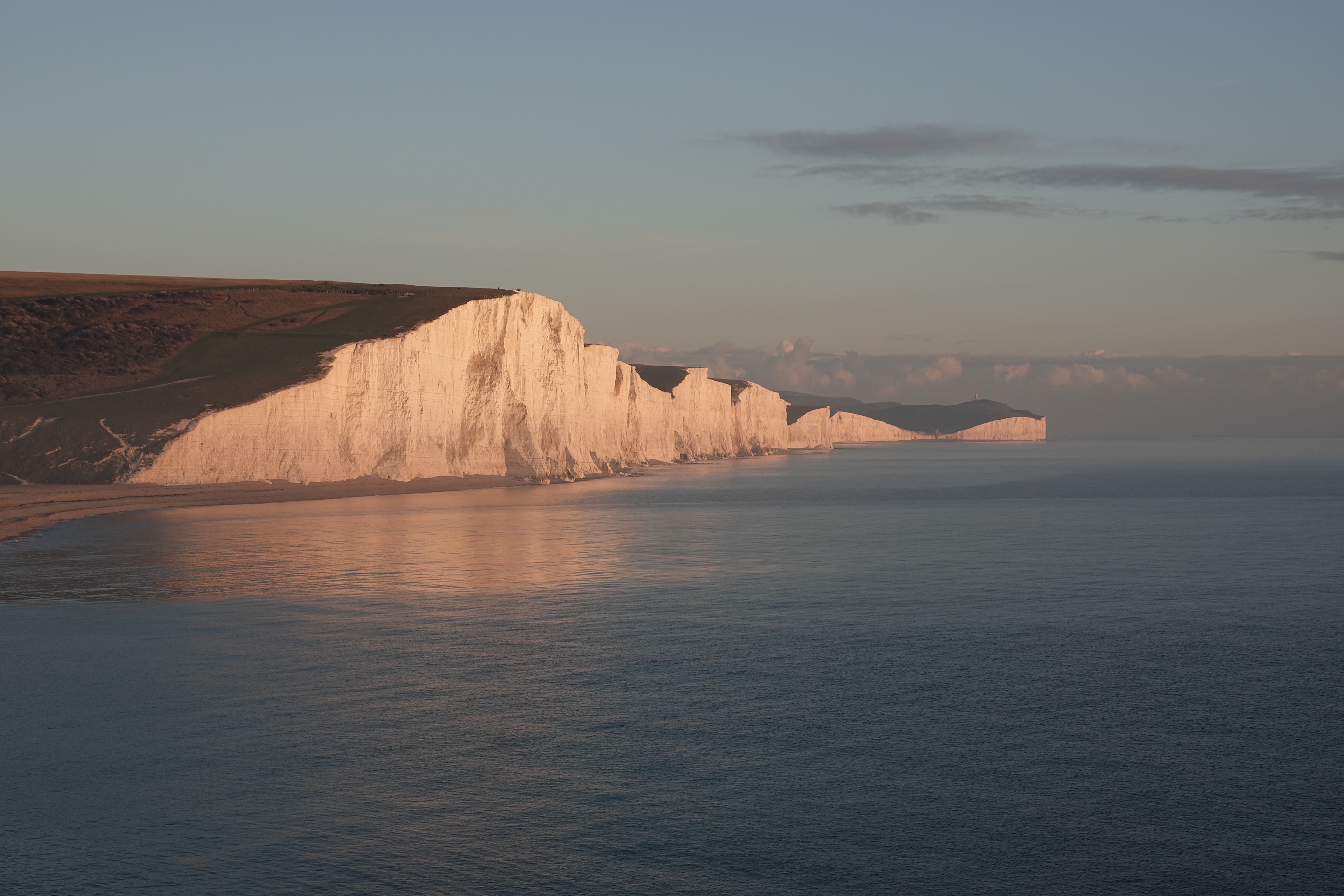
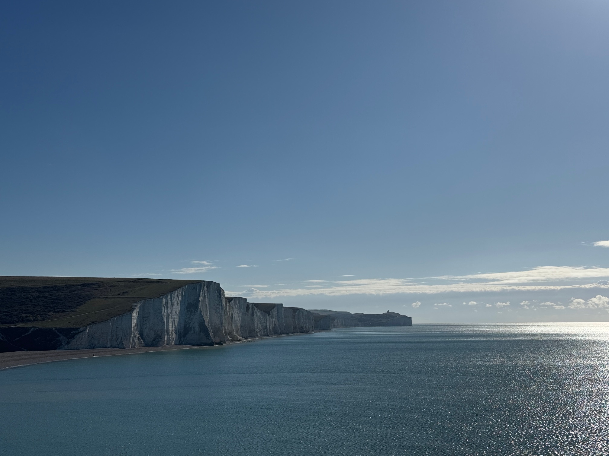
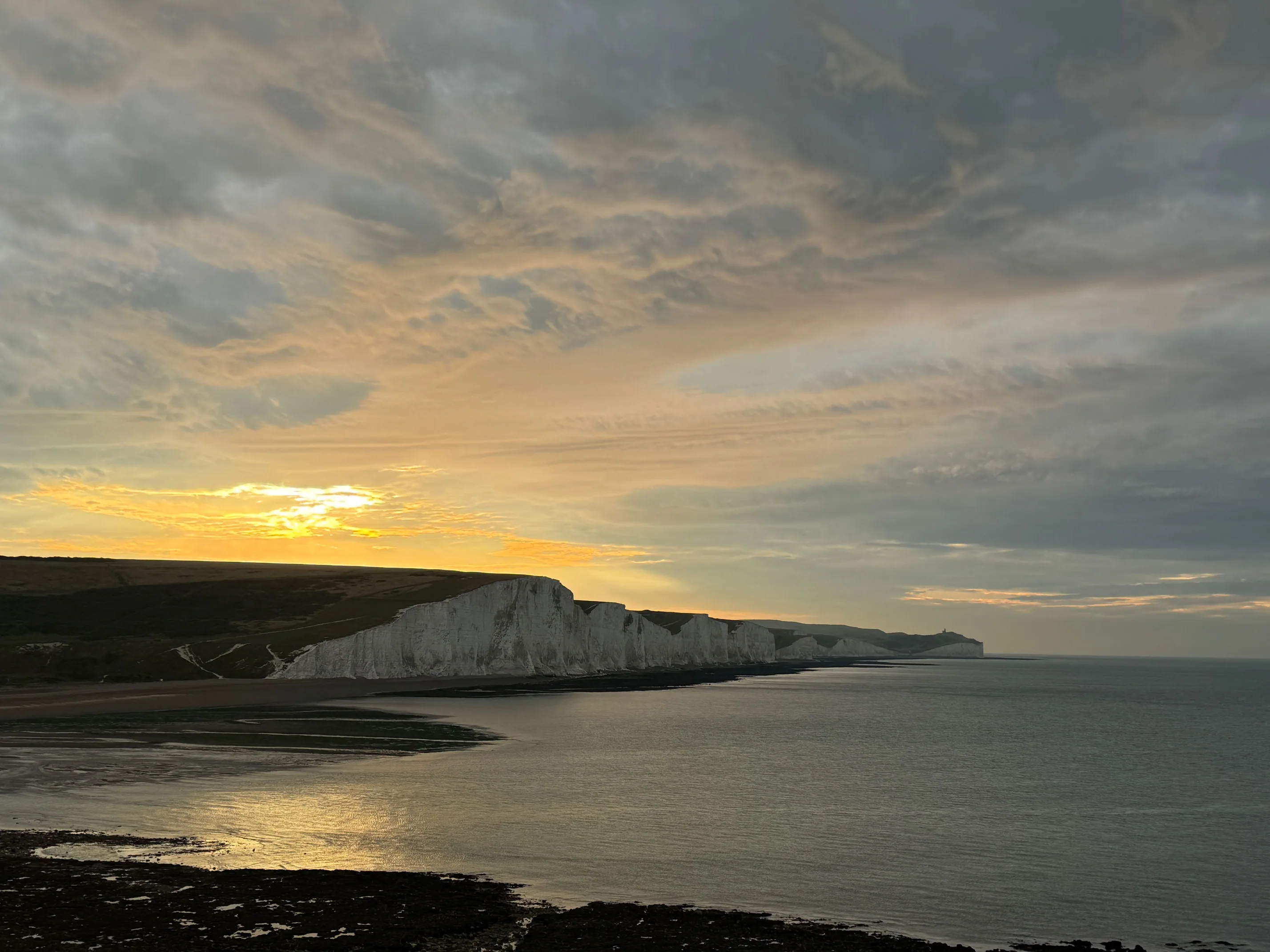
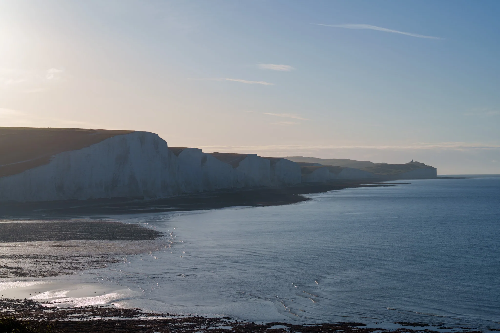
The Seven Sisters and Beachy Head are retreating. Not collapsing — retreating, steadily, at average rates of around 30–50 centimetres per year across the Seven Sisters, and faster at the more exposed sections near Beachy Head and Belle Tout. In storm years the figure rises significantly; in calm years it drops. But the direction never changes.
The mechanism is not what most people imagine. It's not that the wave breaks against the base of the cliff and slowly wears it down like sandpaper. What happens is more sudden and more dramatic. Wave action undercuts the base of the cliff — eating into the chalk at sea level while the cliff face above remains apparently solid. Over time, the overhang becomes structurally unsustainable, and a section of cliff face — anywhere from a few tonnes to thousands of tonnes — detaches and falls. The fallen chalk is then ground up relatively quickly by wave action, the newly exposed cliff face weathers for a season or two, and the process begins again.
From the top of the cliff, this process is invisible right up until the moment it isn't. The cliff edge looks solid. It is solid — at the surface. What you cannot see is the state of the material beneath the surface, and whether the process of undercutting below is already compromising the structural integrity of the ground above.
This is why you stay on the marked path. Not because of a general sense of caution, but because the cliff edge is not always where it was last month. The chalk undercuts invisibly from below. The edge can be closer to your feet than it appears, and the ground immediately beyond the path may be less stable than it looks.
What Belle Tout's Position Tells You About the Timeline
Belle Tout lighthouse was built in 1834, positioned 160 metres from the cliff edge at Beachy Head. By 1902 it had become functionally useless as a navigation aid — the chalk had eroded to the point where the lighthouse was frequently inside clouds or sea fog, obscuring the light from ships that needed it. The Beachy Head lighthouse at the base of the cliff was built as a replacement in 1902 specifically because the cliff had retreated enough to compromise the high-position light.
By 1999, the cliff edge had advanced to within a few metres of Belle Tout's foundations — 165 years of erosion that had consumed most of the 160-metre buffer the original builders thought they had. The 17-metre move bought the lighthouse perhaps another 15–20 years before the question arises again.
Those numbers — 160 metres consumed in 165 years — average out to roughly one metre per year. Which is exactly the long-term average erosion rate for this section of coast. The math is consistent, even if individual years are not.
Seeing the Evidence on the Walk
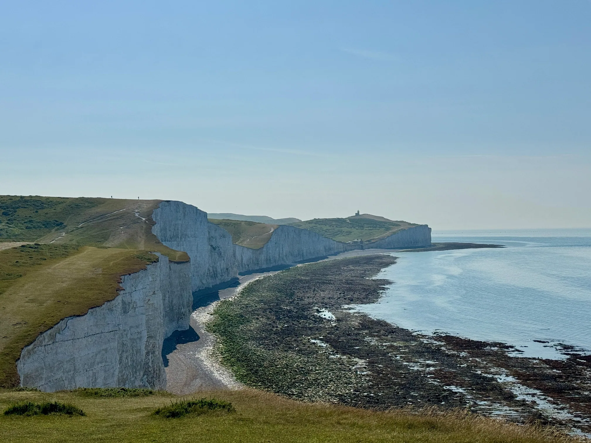
Walking the clifftop path from Birling Gap east toward Beachy Head, the evidence of erosion is everywhere once you know what you're looking for.
The path detouring inland: In several places the marked footpath takes an apparent detour away from what would be the most direct route. These diversions exist because the direct route no longer exists — the cliff advanced and the path was moved. The current path is not the original path.
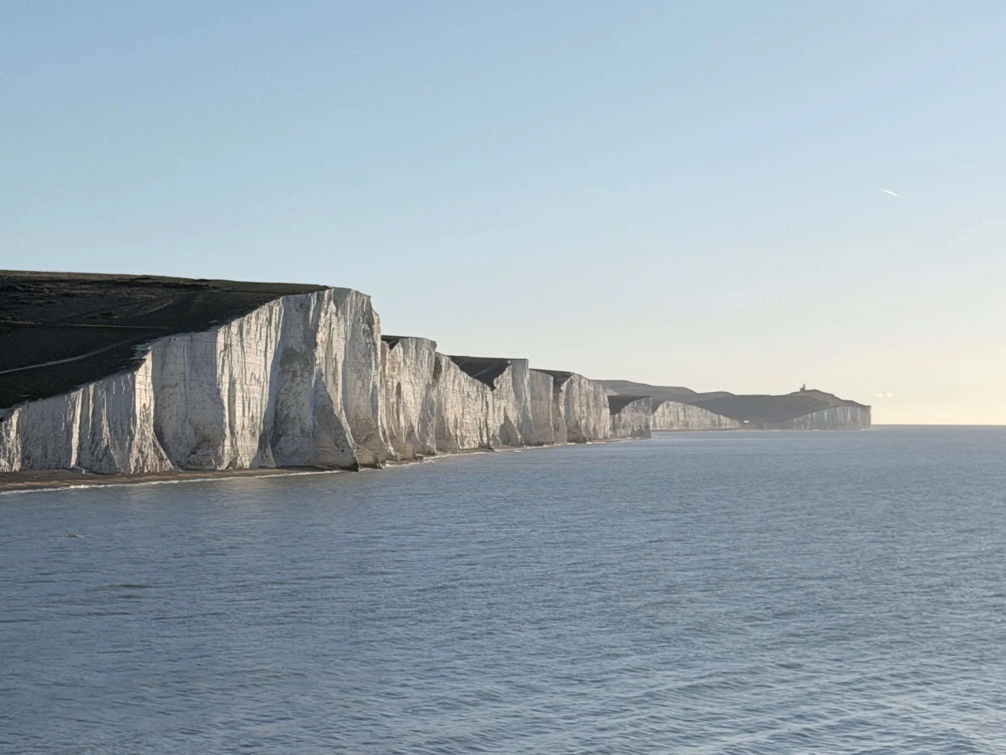
Fresh chalk at the cliff base: If you look down from a safe distance, the fallen chalk at the base of the cliffs is bright white — almost luminous. This chalk hasn't been in the sea long. Recently fallen material hasn't had time to develop the grey-green algae covering that older fallen blocks show. Fresh bright chalk means recent falls.
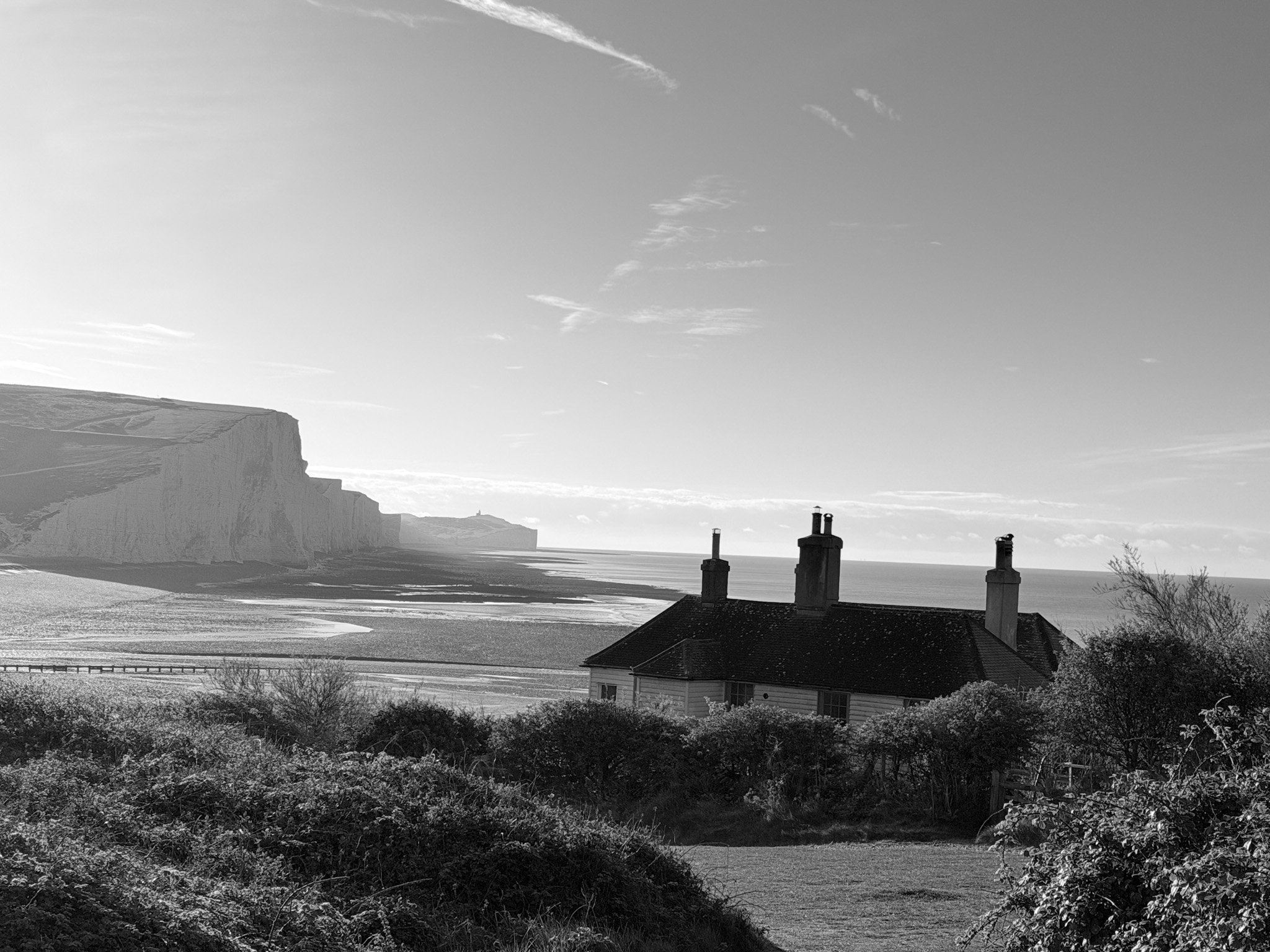
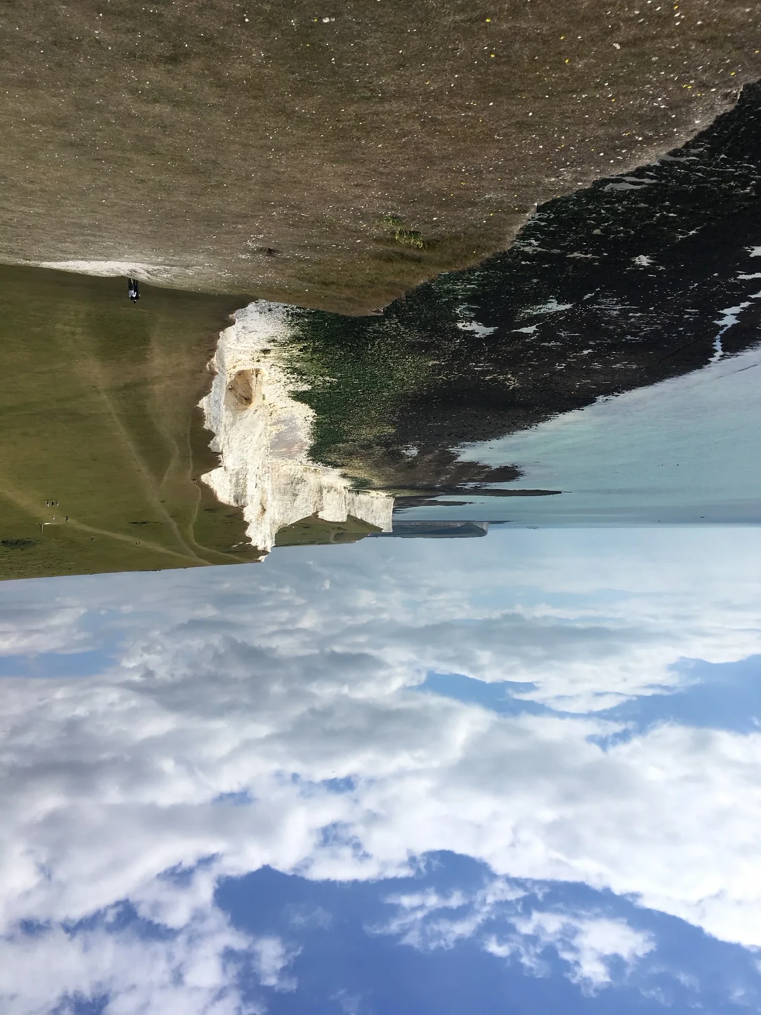
Where Belle Tout used to be: The lighthouse's original foundation site is a slight depression in the turf, a different shade of green from the surrounding downland. It's on the cliff side of the current structure — measurably closer to the edge. You can stand on the filled-in foundations of a Victorian lighthouse and look down at the sea.
The Winter Storm Effect
Erosion at Seven Sisters is not evenly distributed through the year. The mechanism that drives large cliff falls is primarily winter storms — Atlantic low-pressure systems that push significant wave energy against the cliff base for sustained periods. After a winter with several major storms, the spring and summer path inspection typically reveals new falls, adjusted cliff edges, and occasional path closures.
The Birling Gap steps — the wooden staircase giving access to the beach — have been rebuilt and relocated multiple times as the cliff behind them has advanced. The current structure sits on the same physical location as stairs that were there 30 years ago, but the stairs themselves have been moved seaward several times as the ground above retreated. The fact that the steps exist at all is a choice that is reviewed regularly.
What This Means for Walking the Cliffs Safely
None of this is cause for alarm about walking the clifftop path. Millions of people walk it every year. The path is regularly inspected and rerouted when necessary. The risks are manageable if you take them seriously.
What it means in practice:
The path is the safe zone. The marked path is positioned with cliff-edge safety in mind. Walking off the path, approaching the edge for a photo, or standing near an apparently solid edge is statistically riskier than it looks, because the chalk undercutting is invisible from above.
After a storm, give it time. A major storm in winter or spring may be followed by cliff falls in the weeks and months afterward as freshly undercut sections destabilise. If you're walking within a few weeks of significant storms, be more conservative about edge proximity than usual.
Cliff edge at night or in fog is a serious hazard. In reduced visibility the edge is invisible. There's no fence, no lighting, no indication until you're at it. If you're walking in fog or near dark, move to the inland side of the path.
Belle Tout Quick Facts
Built: 1834, positioned 160m from the cliff edge
Decommissioned: 1902 (replaced by Beachy Head lighthouse at sea level)
Moved: March 1999, 17 metres inland, taking 18 days
Cost of relocation: £265,000
Current use: Bed and breakfast accommodation (bookable, not free to enter)
Original foundation site: Visible as a slightly different patch of turf on the cliff side of the building — closer to the edge
Approximate years of usability remaining: 15–20 years before relocation would need to be considered again, at current erosion rates
The Beachy Head Lighthouse: The Other Half of the Story
The red and white striped lighthouse at the base of Beachy Head is 43 metres tall. Built in 1902 to replace Belle Tout when the clifftop position became untenable. From the clifftop directly above, it looks like a toy — the perspective is so extreme that the scale is almost impossible to read.
It was built on the chalk wave-cut platform at the base of the cliff — the relatively flat area that the sea has eroded over thousands of years. It has its own relationship with the retreating cliff above: major cliff falls are a risk to the structure, and the lighthouse has been subject to several near-misses from falls that landed close to its base. It became fully automated in 1983. Nobody lives in it.
Standing on the clifftop above Beachy Head lighthouse and looking straight down at it is one of those experiences that requires a moment to properly resolve — the distance, the scale, the vertiginous drop. It's worth walking from Birling Gap for this alone.
More Seven Sisters History and Geology Guides
For the full geology of the chalk cliffs including how they form and why they're white, see our geology guide. For the complete coastal erosion story and what's changing year by year, see our coastal erosion guide. For the walk from Birling Gap to Beachy Head with route notes and timing, see our Beachy Head and Seven Sisters walk guide.
We may earn a small commission on bookings made through this link, at no extra cost to you. More info.
£4.99 · 24-page PDF · Instant download
The Seven Sisters Ultimate Guide
The complete 24-page companion built from first-hand walks — every cliff, all four graded routes, tide windows and a parking strategy. Designed to work offline, right on the cliff top.
- All 7 cliffs — heights, geology & viewpoints
- Four graded walking routes, fully mapped
- Tide windows, light calendar & day plans
- Parking strategy & seasonal planner
Just want the basics? Download the free 2-page walk guide
Want an expert-led Seven Sisters tour?
From guided cliff walks and wildlife safaris to geology hikes and photography tours — explore all our curated experiences with local guides.