Seven Sisters Hidden Gems: Secret Beaches & Lesser-Known Viewpoints
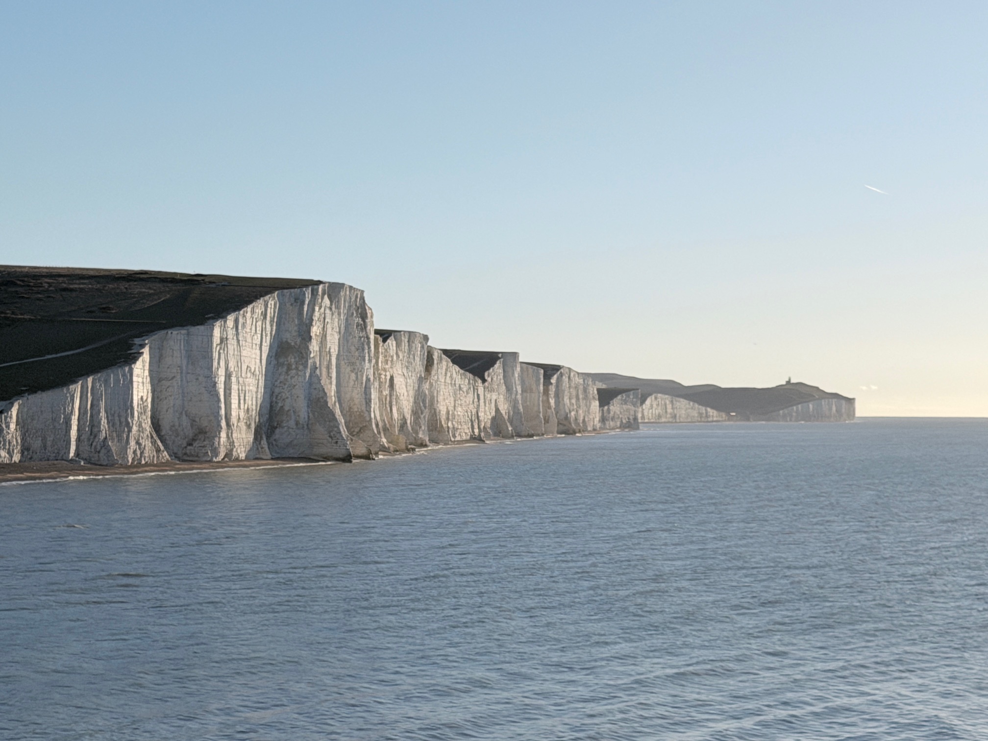
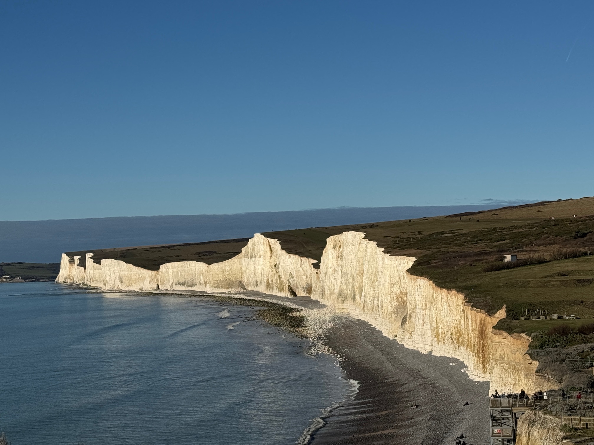
Birling Gap on a Sunday in August: tour buses, the car park queue extending down the road, the path between Cuckmere Haven and the cliff edge shoulder-to-shoulder. It's still spectacular — the cliffs don't care about the crowds — but it's not the Seven Sisters most regulars actually visit. Most regulars have long since learned where the crowds aren't.
Here's what they know.
The "Spread the Love" Philosophy
Before diving into specific locations, understand the conservation rationale for this guide. Concentrating visitor numbers in few locations means those locations experience intense impact (trampling, erosion, litter, noise). Spreading visitors across more locations distributes impact, making it sustainable. By visiting lesser-known spots, you:
- Reduce pressure on famous viewpoints (allowing them to recover)
- Support more sustainable distribution of impacts
- Experience genuine solitude and discovery
- Find unique experiences unavailable at crowded locations
This isn't about being contrarian or exclusive. It's genuinely better for the landscape and better for your experience. Everyone wins when visitors spread out.
Hidden Gems by Location and Type
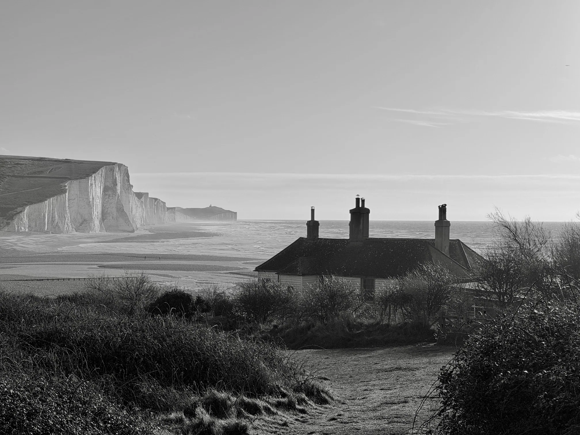
The Westernmost Viewpoint: Cuckmere Haven (Quiet Observation)
Location: Far western end of the Seven Sisters complex, opposite the Cuckmere River mouth.
Access: From Exceat visitor centre, walk toward Cuckmere Haven (standard easy walk along the river). But continue past the usual destination beach. The viewpoint is approximately 200 metres east of the river mouth, on the low cliff overlooking the beach and the mouth itself. Most visitors turn back at the river; very few continue to this viewpoint.
What's special: This location offers perspective looking both back at the Seven Sisters (you see them as a receding line eastward) and forward at the river delta. The river mouth creates an interesting ecological junction—salt marsh, river, sea meeting. Seabirds concentrate here (waders, terns, seagulls). The view is less iconic than Seaford Head, but it's genuinely beautiful and specific—you understand the landscape's complexity, not just cliff drama.
Best times: Early morning (birds are active, fewer people), low tide (more beach is visible), spring/autumn (migration brings bird diversity). Late afternoon light is warm but less dramatic than evening golden hour at eastern viewpoints (west-facing means morning light is better than evening).
Practical tips: The walk is easy but longer than popular routes (45 minutes round-trip from visitor centre). Water and snacks recommended. Tide times matter—at high tide, the beach is minimal; plan for low tide if you want beach access. The river mouth area can be muddy; waterproof boots helpful.
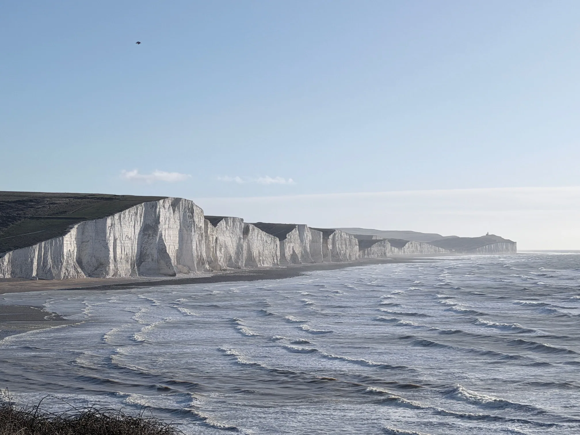
The Clifftop Path Between Famous Points: Birling Gap to Belle Tout
Location: The 2 km clifftop path connecting Birling Gap with Belle Tout Lighthouse.
Access: From Birling Gap car park, take the upper clifftop path (not the beach path) toward Belle Tout. This path is well-marked but less crowded than beach-level routes. Most tourists use car parks at both ends; fewer walk the connecting path.
What's special: This path offers continuous clifftop views with intimate perspectives—you're close enough to see detail but not overwhelmed by scale. The path passes through chalk grassland (excellent for wildflower photography in spring/summer). The Belle Tout Lighthouse comes gradually into view, creating compositional interest. Because fewer people use this route, wildlife is less disturbed and more visible.
Best times: Spring (wildflowers, migrating birds), autumn (colours, fewer crowds), morning (better light angle, fewer people). Avoid midday summer when heat and crowds are both intense.
Practical tips: This is an out-and-back route (4 km round-trip). The path is well-maintained. No facilities between Birling Gap and Belle Tout—bring water and snacks. The exposure is moderate; strong wind can feel significant but isn't dangerous if you're careful.
Friston Forest Hidden Clearings and Viewpoints
Location: Interior forest clearings within Friston Forest (north of the main cliffs).
Access: Start at Foxhole car park (free parking, rarely full). Take the main loop walk, but at various junctions, turn onto smaller trails diverging from the main path. These lead to hidden clearings offering unexpected views. No official markers, but paths are relatively clear—stay alert for navigation.
What's special: These clearings offer sudden perspective shifts—you emerge from forest into open space with views back over treetops toward the coast. These moments of visual surprise are delightful. The clearings are typically empty even on busy days because few visitors explore beyond main loops. Some clearings have natural seats (fallen trees, rocks) inviting rest and observation.
Best times: Autumn (golden light through canopy, colour spectacular), spring (underbrush flowering, bird activity). Any time is good if you can be there early morning or late afternoon (fewer people, better light).
Practical tips: Navigation requires attention. Bring a map or GPS. The clearings are far enough from main paths that getting lost is possible (unlikely to be dangerous but could be disorienting). These explorations are best for experienced navigators or groups (navigation is more reliable). Alternatively, hire a local guide familiar with forest trails.
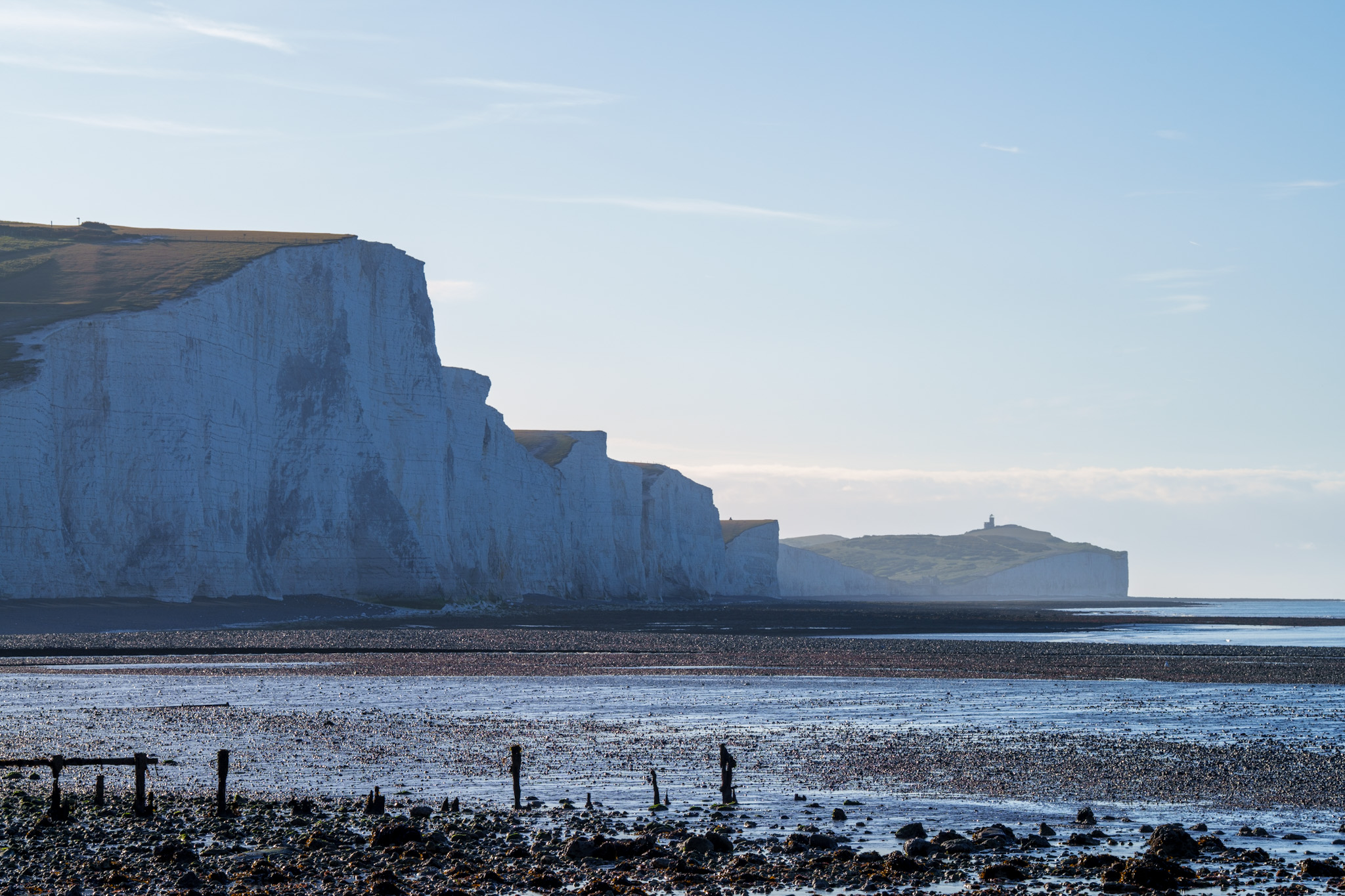
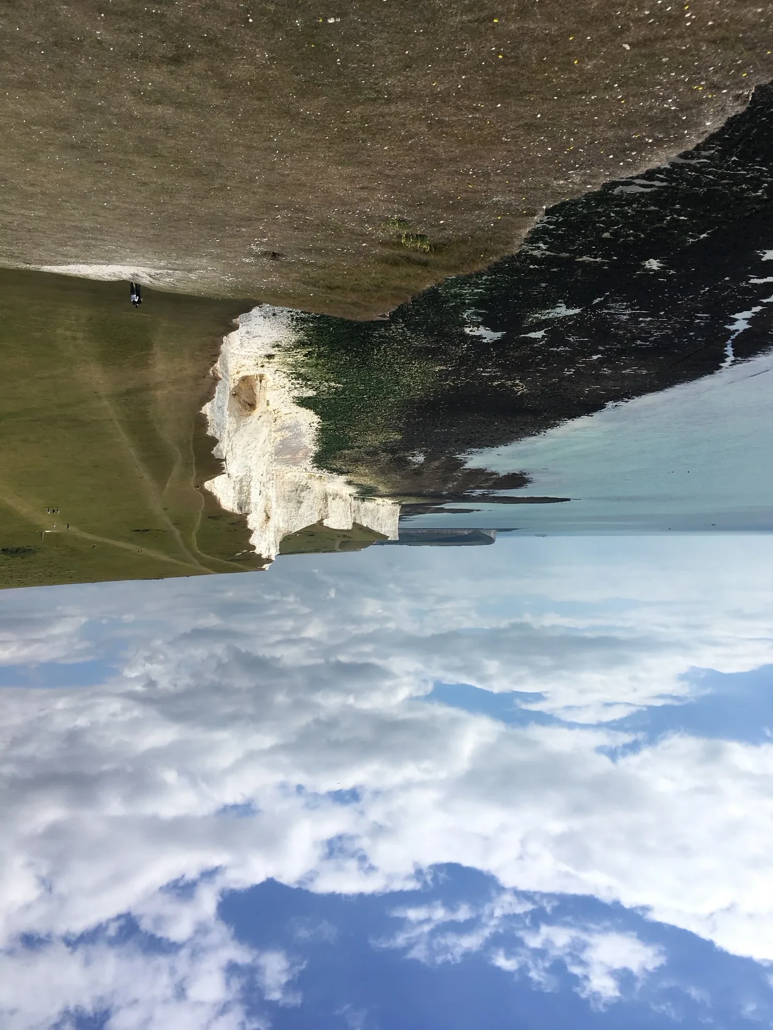
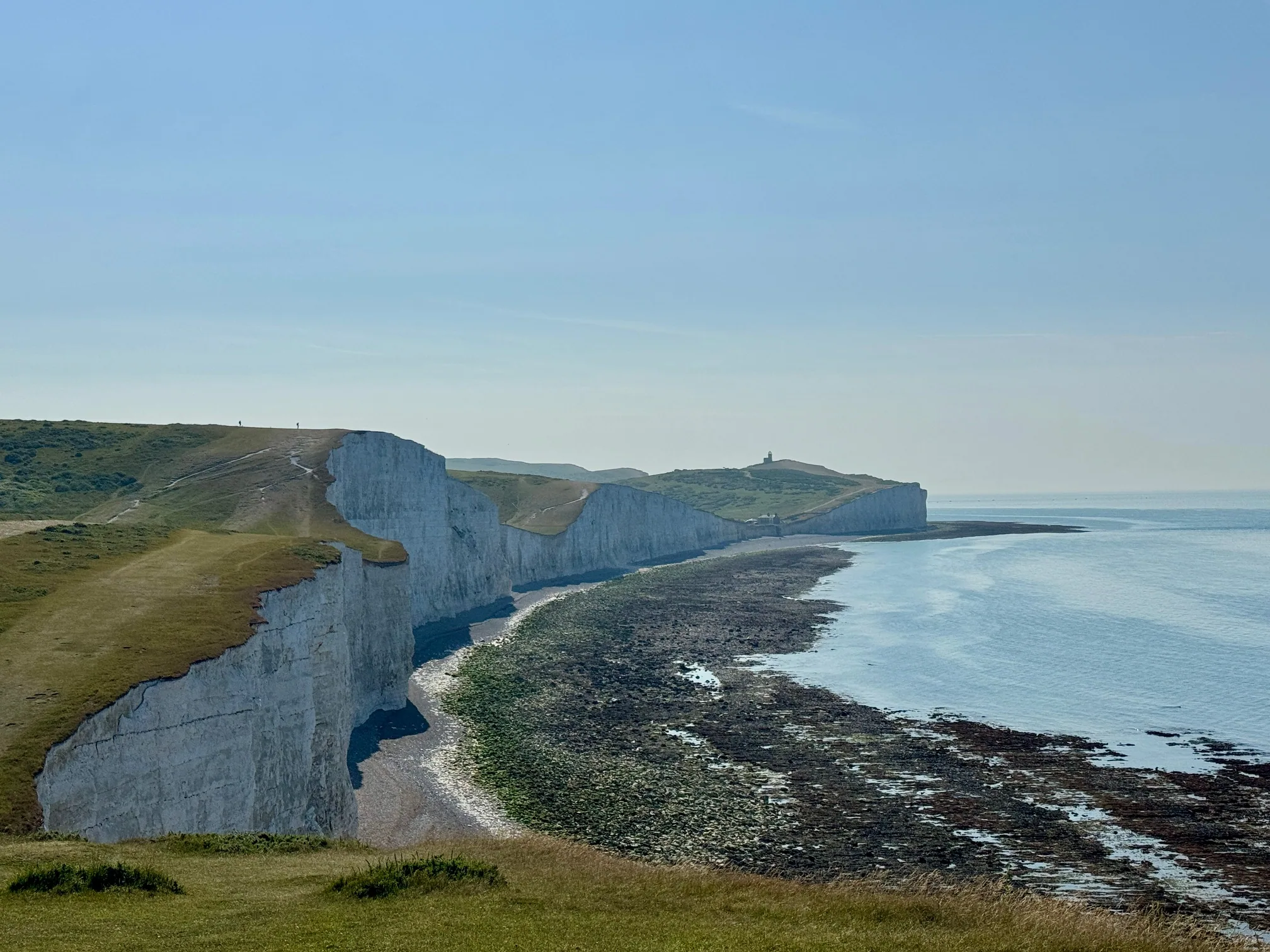
Hope Gap (Intimate Geology)
Location: A distinctive notch in the cliffs 500 metres east of the main Seaford Head viewpoint, where a small valley cuts down to sea level.
Access: Start from Splash Point car park in Seaford — the same starting point as the main Seaford Head walk. Follow the eastern clifftop path for about 5 minutes; Hope Gap is the V-shaped notch ahead. Most visitors set off toward the obvious high point of Seaford Head and never explore this far, which is why it stays quiet.
What's special: Hope Gap offers virtually the same westward view of the Seven Sisters as Seaford Head, from a slightly lower, more side-on angle, with a fraction of the visitors. At low tide you can scramble down to the shore for tide pools and close-up views of the chalk layers and flint bands. This location offers a completely different aesthetic from the iconic open vistas — intimate, close, specific.
Best times: Any season — low tide if you want to reach the shore below. Overcast days work well here (the narrow space means bright sun can create harsh contrast).
Practical tips: The clifftop approach is an easy 5-minute walk from the car park. The descent to the shore is a steep, loose scramble with no proper path — doable in proper boots if you're reasonably agile, but stay well back from the cliff edge itself, which is particularly unstable here. Fewer visitors mean more solitude and less wildlife disturbance.
East Dean Village Walks (Community & Countryside)
Location: The small village of East Dean sits north of the cliffs in rolling downland.
Access: Drive or bike to East Dean (signposted from Birling Gap, about 5 km away). Park in the village. Several walks start from the village, ranging 3-10 km through rolling countryside, villages, and bridleways.
What's special: These walks offer completely different character from clifftop walking—you're in intimate countryside, passing through villages, farmland, and woodland. The walks connect to the cliff area via bridleways. This location appeals to those seeking countryside character over coastal drama. The village itself has character (old pub, flint cottages, quiet lanes). This is where locals walk—different atmosphere than tourist-focused visitor areas.
Best times: Spring/autumn (pleasant temperatures, less crowded than cliffs). Summer can be hot without coast breezes. Winter is quiet and peaceful.
Practical tips: East Dean is a genuine village where locals live. Be respectful (don't litter, be quiet). The village pub (The Tiger) is worth visiting for lunch or refreshment. Walks from the village require basic navigation skills or printed maps (roads, bridleways, and footpaths are various rights-of-way types requiring attention). These walks are best for people seeking countryside character beyond cliff scenery.
Exceat River Pathway at Different Seasons
Location: The river pathway from Exceat visitor centre to Cuckmere Haven and beyond.
Access: Standard easy walk from Exceat visitor centre. But most visitors walk it during specific seasons (summer). Visiting at different seasons offers completely different experiences—same location, different character.
What's special: The river meadows change dramatically with seasons. Spring brings wildflowers and migrating birds. Summer brings dragonflies, butterflies, and lush greenery. Autumn brings colour and migrating birds. Winter brings bare bones and often water birds. The same walk taken quarterly reveals the four different ecosystems. The river level changes with season—sometimes a trickle, sometimes substantial flow (especially after rain). Solitude increases with season progression (fewer summer tourists by October).
Best times: Visit quarterly to experience seasonal variation. Early morning any season offers solitude. Spring and autumn offer the most dramatic ecological changes.
Practical tips: This walk is accessible to all fitness levels. Timing visits by season extends the discovery process over an entire year. Taking the same photos quarterly reveals how dramatically landscape transforms. This is an excellent location for phenological observation and understanding ecosystem dynamics.
Discovery Strategy: Finding Your Own Hidden Gems
Using Topographic Maps
Detailed maps reveal landscape features not obvious from popular viewpoints. Look for:
- Contour patterns: Where contours cluster tightly, terrain is steep (potential viewpoints). Where contours are far apart, terrain is gentle.
- Water features: Streams, valleys, and gullies create interesting terrain. These often have paths or natural routes.
- Historical paths: Old rights-of-way, ancient trackways, and historic routes often appear on maps. These can be scenic and less-used than modern routes.
- Isolated features: Locations marked with names but no facilities (old farms, ruins, etc.) often mark interesting places worth visiting.
- Triangulation with viewpoints: Maps show many named features. Reaching them offers views of different perspectives on familiar landmarks.
Apps like Komoot, AllTrails, or traditional map apps reveal hiking community ratings and popular routes. However, less-reviewed routes are often excellent and less crowded—use maps to explore beyond established trails.
Timing Strategy: Off-Peak Visiting
Even popular locations are pleasant during off-peak times:
- Weekdays vs. weekends: Popular spots at 9am Tuesday are dramatically different from the same spot at 2pm Saturday.
- Seasons: October offers autumn beauty with fewer crowds. February has peaceful isolation. July-August are peak chaos. November-February are winter emptiness.
- Weather: Rainy days, overcast days, or windy days keep many tourists away. Bad weather days offer solitude and unique aesthetic. Bring waterproofs and embrace the weather—often the best photos and most memorable visits occur in difficult weather.
- Time of day: Most visitors arrive 10am-3pm. Before 8am or after 5pm offers dramatically different experience at the same location.
Local Intelligence
Real insight comes from locals:
- Café workers and shop staff: They live in the area, know where locals go, and willingly share advice.
- Locals walking dogs: Regular dog-walkers know every path and quiet spot. Friendly conversation yields excellent recommendations.
- Conservation organizations: Staff have deep knowledge of hidden locations and ecological significance. They appreciate genuine interest.
- Online forums and local groups: Local photography, walking, and naturalist groups post about favourite locations. Join these groups.
Specific Hidden Beaches and Coves
Tide Pool Exploration Locations
At low tide, rock pools appear with diverse marine life:
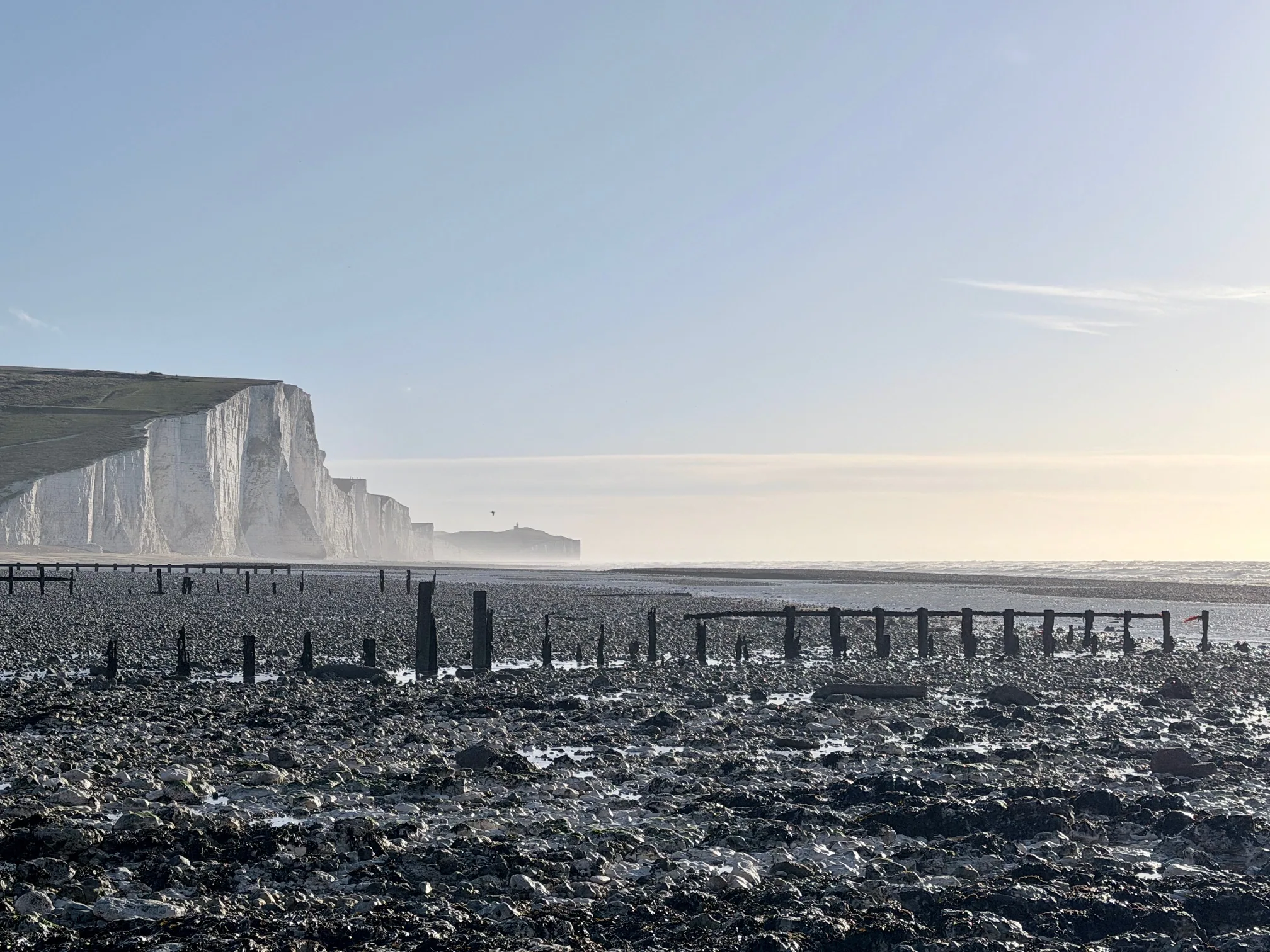
- Birling Gap Beach (around the eastern headland): Walking east along the beach from Birling Gap, tide pools cluster around rocky outcrops. These contain starfish, anemones, small fish, and crustaceans. Pool exploration is fascinating for children and adults. Only accessible at low tide; check tide times. Wear waterproof shoes; rocks are slippery.
- Cuckmere Haven east side: The eastern shore of Cuckmere Haven has small rocky areas with tide pools. Fewer people than Birling Gap tide pools. Accessible at low tide only.
Shingle Beaches for Solitude
Most tourists focus on sand beaches (rare on this coast) or iconic clifftop views. Shingle beaches often go unvisited:
- Seaford Beach (east of Seaford proper): About 30 minutes walk east from Seaford, beaches become increasingly isolated. Few tourists venture this far. The beach is shingle (pebbles) rather than sand, but it offers dramatic cliff views, solitude, and interesting stone formations.
- Areas west of Cuckmere Haven: The beach west of where the river meets the sea has minimal visitor presence. Accessible via clifftop walk or beach walk at low tide. This location offers isolation combined with classic Seven Sisters cliff views.
Photography at Hidden Locations
Hidden gems often offer more interesting photographic opportunities than famous viewpoints (because fewer people mean fewer obstacles, and unique angles create striking images):
- Intimate perspectives: Hidden locations often offer close-up, detailed views rather than grand vistas. These are excellent for detail photography (texture, geology, plants, wildlife).
- Unique angles: Lesser-visited locations mean less-photographed angles. Your images will be fresh and different from typical Seven Sisters shots.
- Wildlife opportunities: Less disturbance means more active wildlife. Better chances for animal photography.
- Self-portraits and group photos: Quiet locations mean you can set up tripods and take your time with composition. Popular locations, you're often rushed by crowds.
Safety and Practicality at Hidden Locations
Navigation and Getting Lost
Hidden locations, by definition, are less marked. Navigation requires attention:
- Bring map and compass or GPS: Don't rely solely on smartphone navigation (battery failure is real). Traditional maps and compass are foolproof backups.
- Tell someone where you're going: If exploring solo, share your plan with someone who will notice if you don't return on schedule.
- Know your limits: If you're uncertain about navigation, go with experienced people or hire a guide.
- Don't panic if temporarily disoriented: Stop, check map, reorient, proceed. Getting slightly off course isn't dangerous if you stay calm.
Solitude vs. Safety
Being alone in remote locations is generally safe but requires practical precautions:
- Inform people of your itinerary: Expected location, expected return time, contact protocol if you're overdue.
- Have emergency communication: Charged phone (even without signal, you can call 999 in UK emergencies).
- Avoid extremely remote locations if solo and inexperienced: The rewards of solitude should be balanced against risk of injury with no one nearby.
- Trust your instincts: If a location feels unsafe or you feel uncomfortable, leave. There are plenty of other beautiful spots.
Start Exploring
For navigation help on the less-trodden routes, our walking routes guide covers the established paths as a foundation. The Hope Gap guide goes into detail on one of the best lesser-known spots.
We may earn a small commission on bookings made through this link, at no extra cost to you. More info.
£4.99 · 24-page PDF · Instant download
The Seven Sisters Ultimate Guide
The complete 24-page companion built from first-hand walks — every cliff, all four graded routes, tide windows and a parking strategy. Designed to work offline, right on the cliff top.
- All 7 cliffs — heights, geology & viewpoints
- Four graded walking routes, fully mapped
- Tide windows, light calendar & day plans
- Parking strategy & seasonal planner
Just want the basics? Download the free 2-page walk guide
Want an expert-led Seven Sisters tour?
From guided cliff walks and wildlife safaris to geology hikes and photography tours — explore all our curated experiences with local guides.