Best UK Coastal Walks to Check on CoastMetric Before You Go
Best UK Coastal Walks — and Why Conditions Matter for Each
Eight spectacular cliff and coastal paths, with live CoastMetric links for every one
Why Live Conditions Change Everything on Coastal Walks
The UK has some of Europe's most dramatic coastline. It also has some of Europe's most changeable weather. On an inland woodland path, a rainy day is a minor inconvenience. On a chalk headland with a 160-metre drop to one side, strong gusts and a low visibility score are a different matter.
CoastMetric covers 100 UK walking locations — cliff paths, national parks, coastal AONBs — combining live tide, weather, wind, path conditions, sea state and transport data into a single Visit Score. Below are eight of the best coastal walks in Britain, with direct links to their live conditions page and what the score means specifically for each location.
How to use this guide: Click any CoastMetric link to see real-time conditions. Scores above 70 are generally good; below 50 means at least one significant factor is problematic. Always check the component breakdown, not just the headline number.
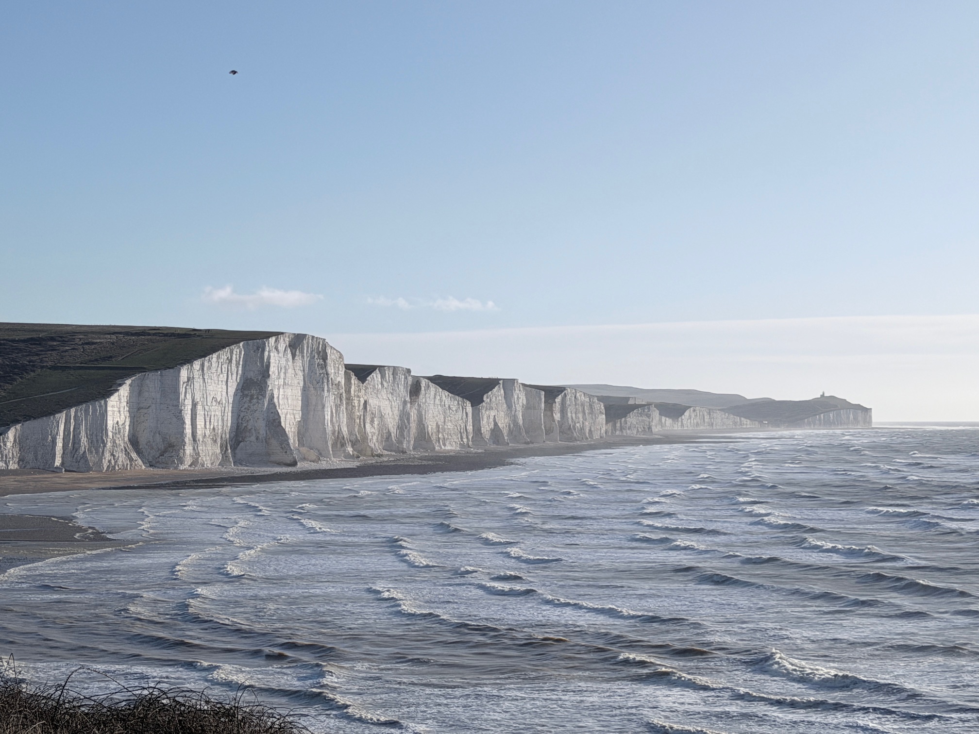
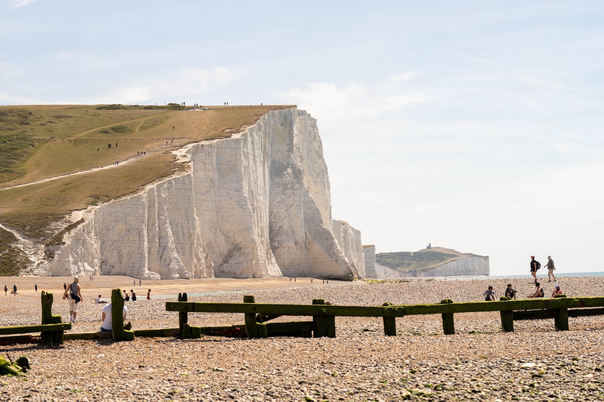
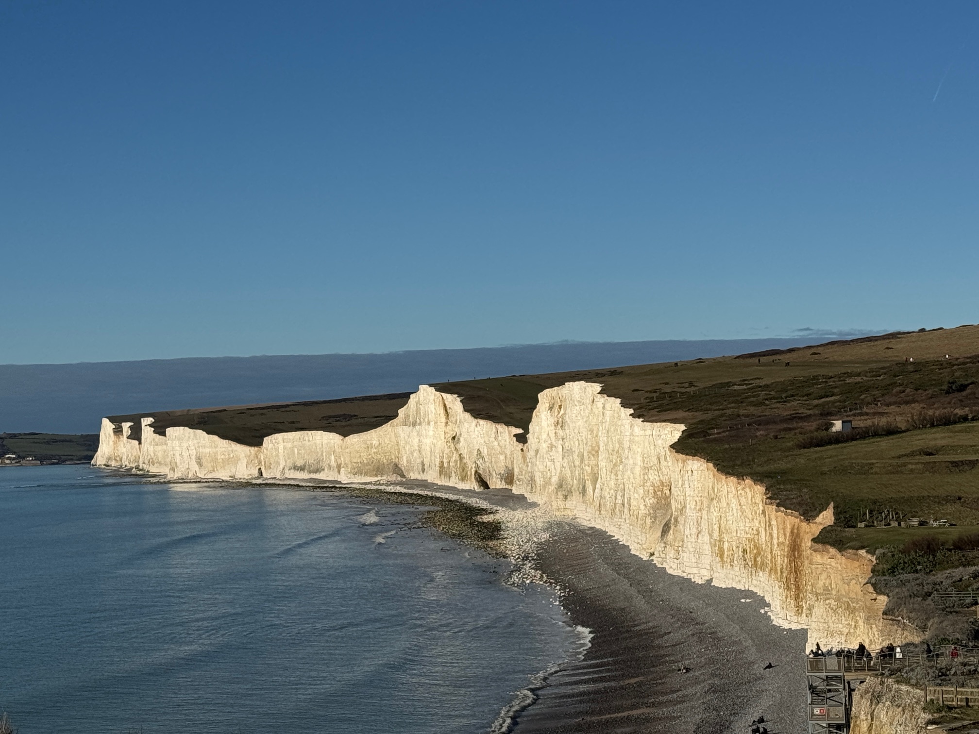
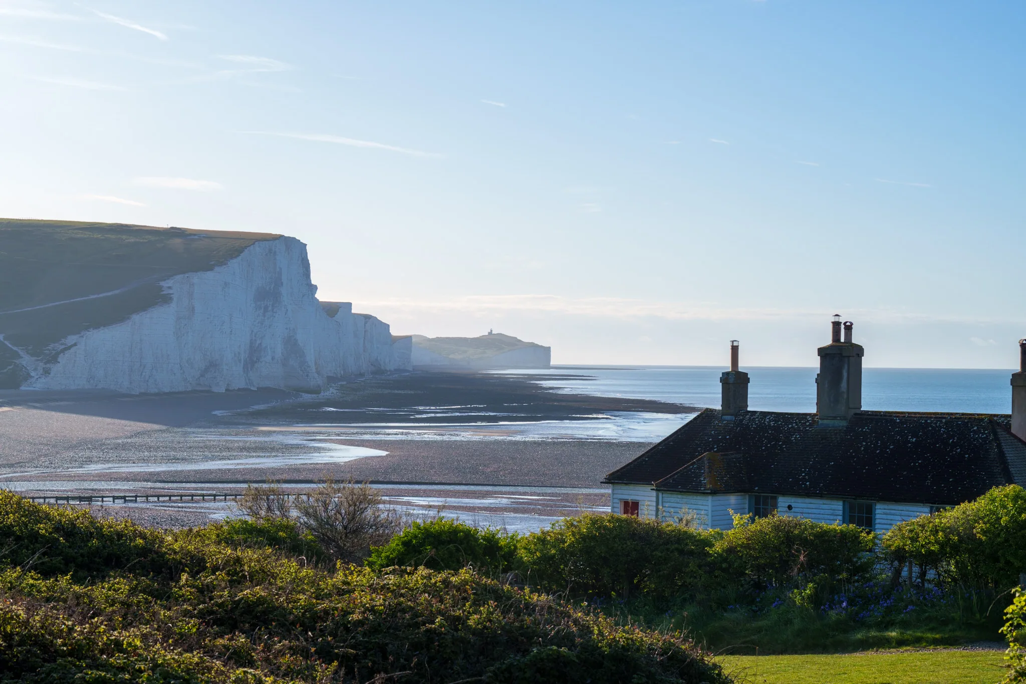
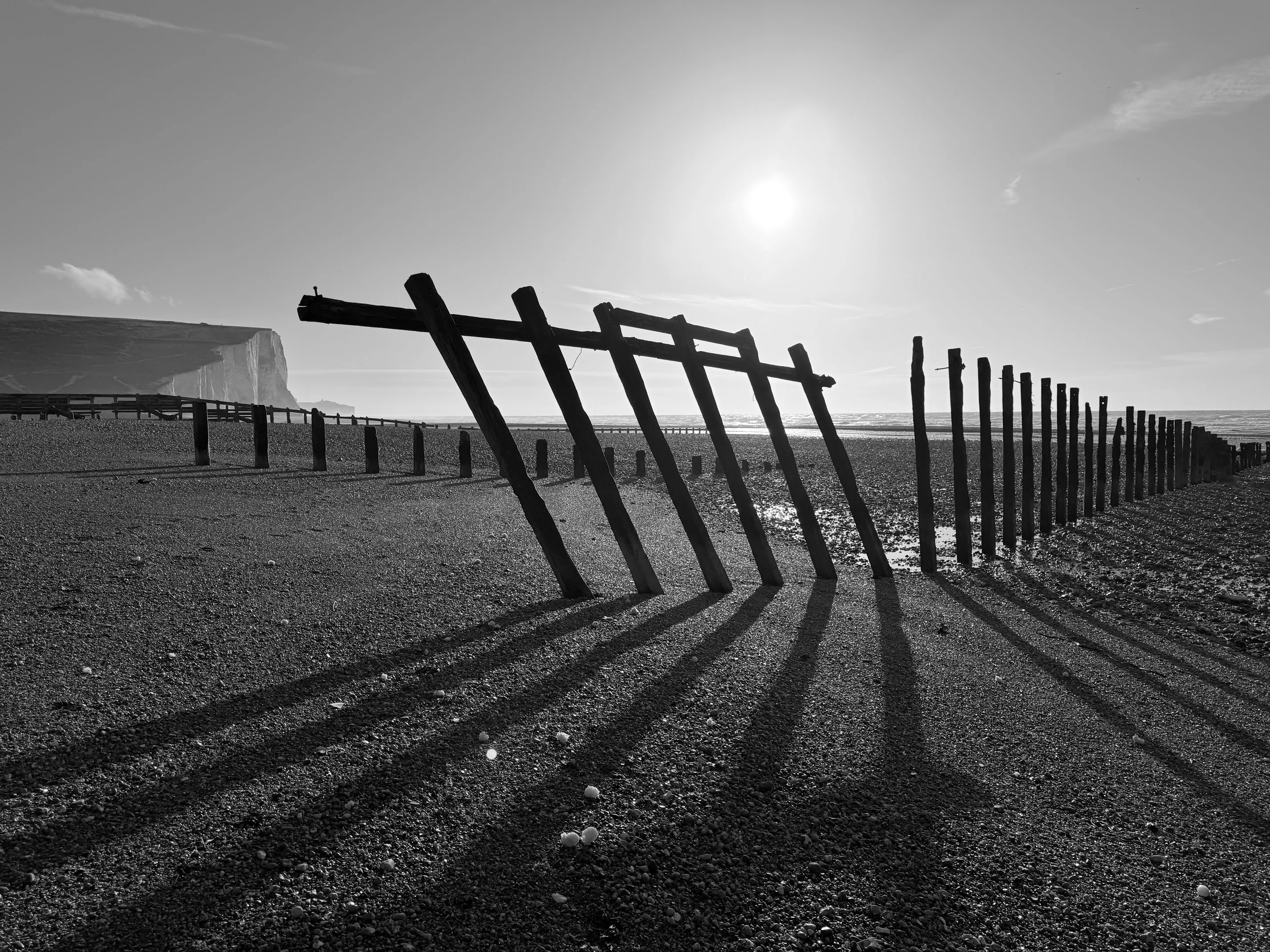
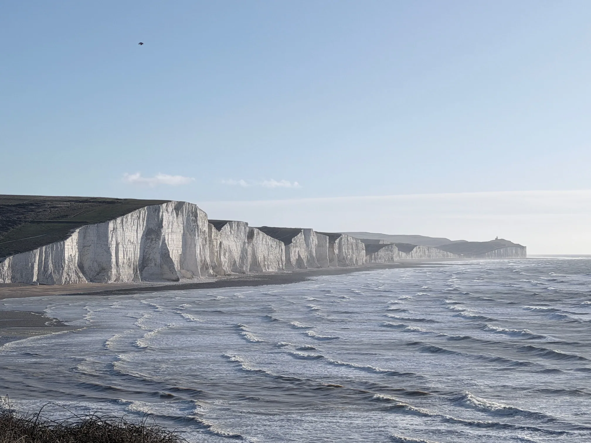
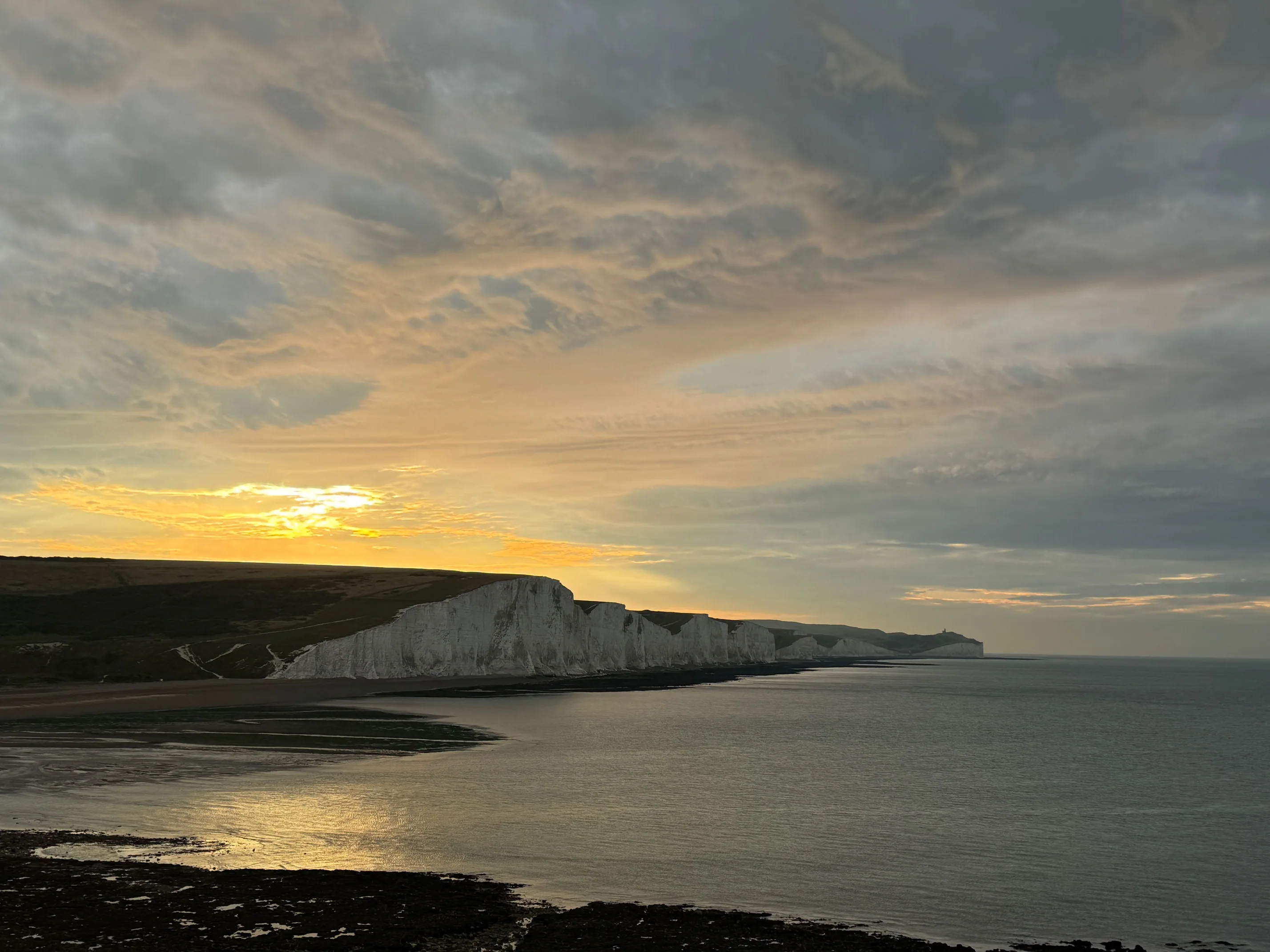
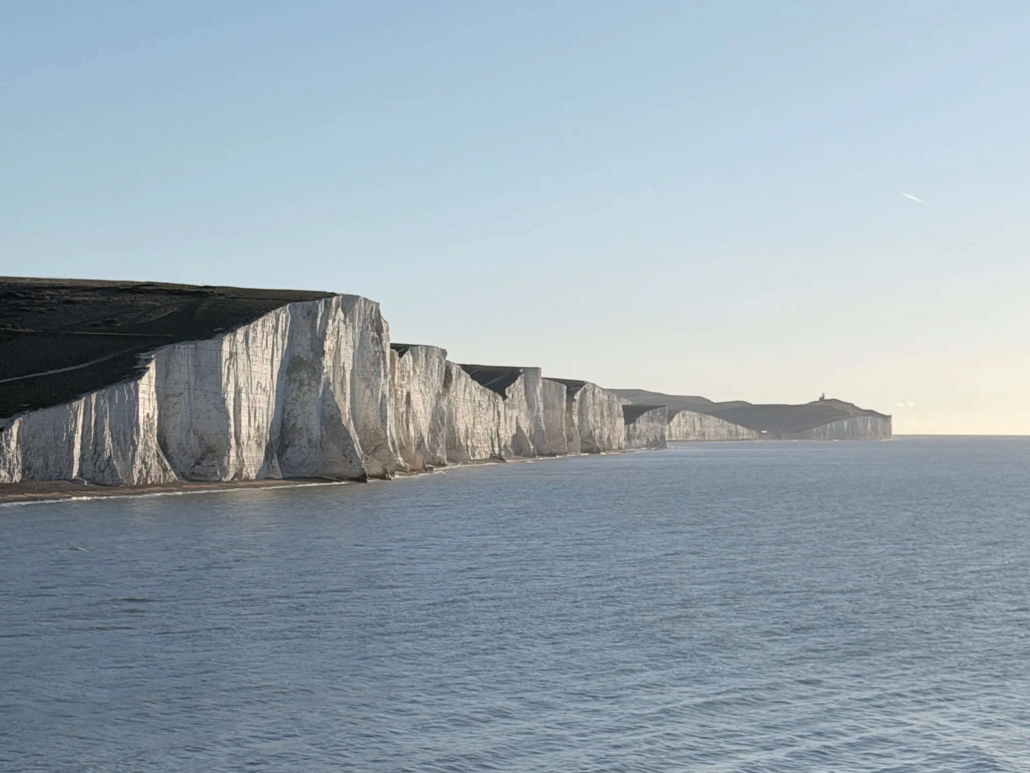
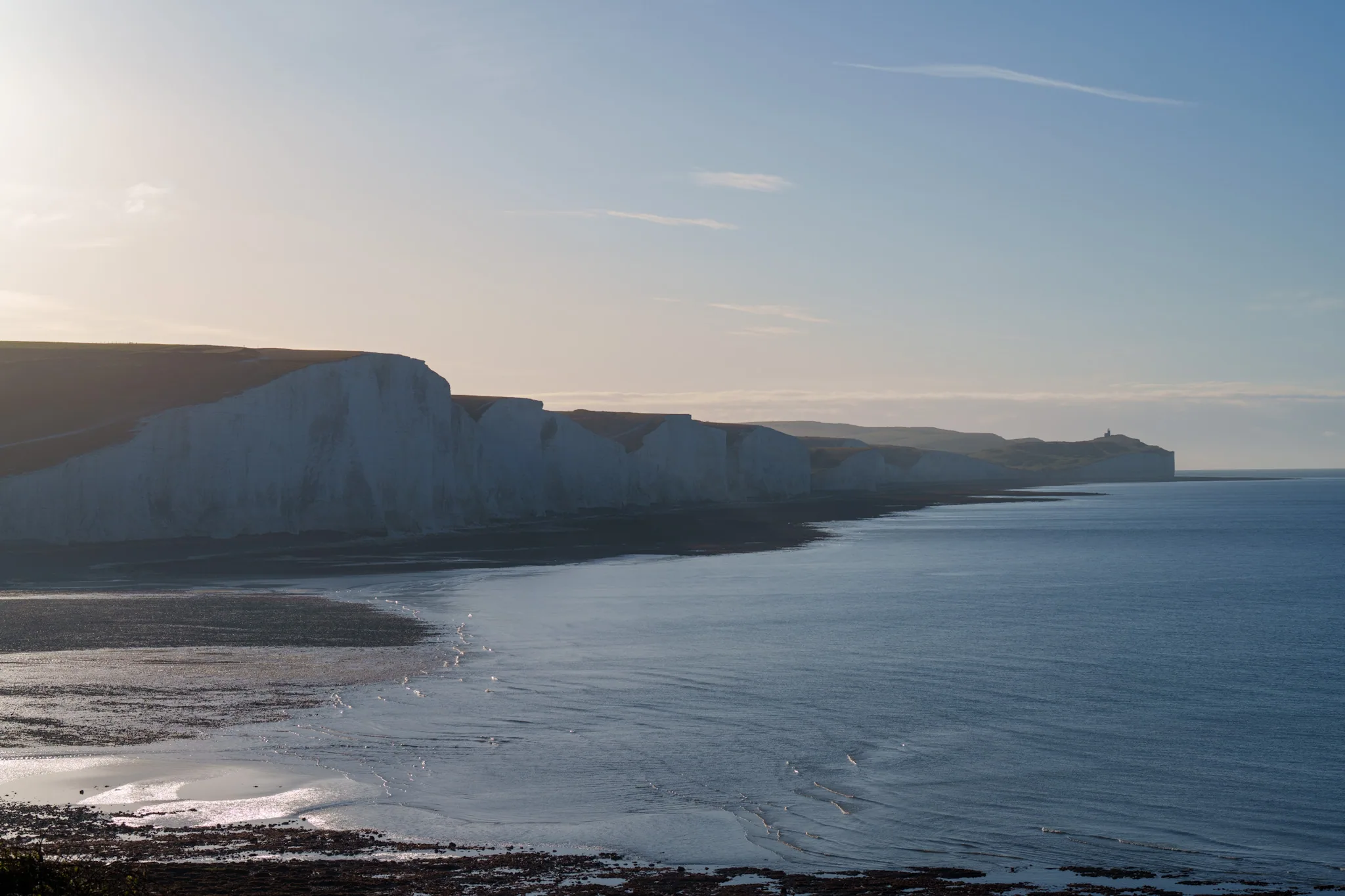
Seven Sisters
Seven chalk headlands stretching 5 miles (8km) between Birling Gap and Seaford Head. The cliff top path runs right along the edge with minimal fencing; on a clear day the views across the English Channel are as good as England gets. On a bad day, it's exposed, slippery chalk, and wind gusts that make the cliff edge feel very close.
Key conditions to check
Wind (cliff exposure), path grip after rain, tide times for Cuckmere
Full walk distance
7 miles one-way, Birling Gap to Seaford (or reverse). Allow 3.5–5 hours.
Best season
Late April to October. May for wildflowers, September for low crowds.
What CoastMetric adds here: The path grip component is particularly valuable — chalk paths after rain are genuinely dangerous, and the score reflects recent precipitation and soil saturation in a way a standard weather app doesn't. Check the component breakdown directly on the CoastMetric page for a detailed reading of each factor.
White Cliffs of Dover
The most iconic cliffs in England, and probably the most recognisable coastline in Britain. The National Trust clifftop walk from the visitor centre to South Foreland Lighthouse is 4 miles return and manageable for most walkers. The cliffs here top out at 110 metres — taller than any of the Seven Sisters cliffs (Haven Brow reaches 77m), but lower than Beachy Head (162m). Dramatic vertical faces and clear-day views across to France.
Key conditions to check
Visibility (France visible at 80+ score), wind on the exposed headland
Main walk
4 miles return from NT visitor centre. Lighthouse extension adds 2 miles.
Notable
On high-visibility days you can see 20+ miles to the French coast. Check the visibility score before making the trip for this reason specifically.
Durdle Door & the Jurassic Coast
England's most photographed natural arch, set into a 300-million-year-old limestone headland. The walk from Lulworth Cove to Durdle Door is only 1.5 miles but deceptively steep — the headland rises sharply from sea level and the return is harder than the approach. The broader Jurassic Coast section extends 95 miles from Exmouth to Studland. CoastMetric covers the main trailhead area.
Key conditions to check
Path grip (steep descent to arch), sea conditions if swimming at Man O'War Bay
Tidal note
Lulworth Cove beach access varies significantly with tide. Check before planning beach time.
UNESCO status
World Heritage Site. The geology here is unlike anywhere else in England — visible in the rock layers at the arch base.
Giants Causeway Coastal Path
40,000 interlocking basalt columns, formed by ancient volcanic activity. The causeway itself is at sea level, which means tidal conditions matter far more than most visitors realise — some of the best column formations are inaccessible at high tide. The Causeway Coastal Route from the visitor centre to Dunseverick Castle is 8 miles of genuine coastal drama, significantly more challenging than the visitor centre loop.
Key conditions to check
Tide (critical for causeway access), wind on the exposed Antrim plateau, visibility
Atlantic exposure
More exposed to Atlantic weather systems than mainland England. Wind scores here often tell a different story to inland forecasts.
UNESCO status
World Heritage Site. Peak season crowds are intense — consider a shoulder season visit if the conditions score allows.
Pembrokeshire Coast Path
The only UK National Park defined primarily by its coastline. The 186-mile coast path is one of Britain's best long-distance walks, though most visitors tackle shorter sections. St David's Head to Whitesands Bay, Stackpole Head circuit, Barafundle Bay — each section has its own character. The St David's peninsula in particular is extraordinarily exposed to Atlantic westerlies.
Key conditions to check
Wind on the St David's headland, sea conditions if kayaking (popular here), bathing water quality at Barafundle
Notable feature
Bathing water quality is excellent here but CoastMetric's water quality flag is worth checking, especially after heavy rain.
Best section for a day walk
Stackpole Head to Barafundle Bay — 4 miles, outstanding cliff and beach scenery, manageable for most fitness levels.
Land's End & the Penwith Peninsula
The most south-westerly point of mainland Britain. Skip the tourist complex and walk north along the cliff path toward Cape Cornwall — this 6-mile stretch is some of the most dramatic granite coastline in England, with sea stacks, ancient fogous, and Iron Age cliff castles. The granite headlands here take Atlantic swell directly and the wind scores can be brutal — but also spectacular.
Key conditions to check
Wind (Atlantic-facing exposure), sea conditions (swell hits here directly), visibility for the Longships Lighthouse views
Atlantic swell
Sea conditions here are often 2–3x what they are on the English Channel coast. The 5% sea conditions weighting understates it for this location.
Best for
Storm watching in winter (safe distances), dramatic photography in any season, summer wildflowers on the clifftop heath.
Flamborough Head
England's only chalk headland on the North Sea coast, and one of the least-visited great coastal walks in the country. The cliff path from Thornwick Bay to Bempton Cliffs takes in sea stacks, caves, arches, and Britain's largest mainland seabird colony — over 200,000 birds including the UK's only mainland gannetry. Visibility scores matter here: in low visibility the seabird spectacle disappears.
Key conditions to check
Visibility (seabird watching), wind (North Sea exposure — colder than the south coast equivalent), path grip after rain
Best season
May to July for seabirds. Gannets, puffins, razorbills, kittiwakes. Outside this window the cliffs are quieter but still dramatic.
Underrated
Consistently underrated in "best UK walks" lists. If Seven Sisters is too busy, this delivers similar geology with a fraction of the crowds.
Torridon & Northwest Highlands Coast
Ancient Torridonian sandstone, lochs that reach the sea, 750-million-year-old rock exposed in roadside cuttings. The Torridon coastal path and the Beinn Eighe circuit are among the most remote and serious walks covered by CoastMetric. This is not a walk you improvise — the consequences of misjudging conditions here are significantly higher than on a managed cliff path in East Sussex.
Key conditions to check
All eight components carefully. Wind, temperature and daylight are critical — this is serious mountain and coastal terrain.
Remoteness factor
No phone signal on most of the route. No nearby rescue services. A poor conditions score here means don't go — not "go anyway."
Best season
June to August for most accessible conditions. September for autumn colours and reduced midges. Winter requires full mountain skills.
How to Get the Most from CoastMetric on Any Coastal Walk
Check the intraday forecast, not just the snapshot
A 4-hour walk should be checked across the 3-hour and 6-hour forward projections, not just the current score. Weather on exposed coastal paths can change significantly within a single walk.
Weight the components differently per location
Wind matters most at Seven Sisters and Flamborough Head. Tide matters most at Giants Causeway and Cuckmere Haven. Sea conditions matter most at Land's End and Torridon. Read the component breakdown, not just the headline number.
Use it for transport planning too
CoastMetric shows live bus and train departures near each trailhead. Useful for one-way walks where the return journey depends on public transport — especially at Seven Sisters and the Pembrokeshire coast.
Free, no login, works on any device
No app to download. Open coastmetric.com on your phone browser before you leave, screenshot the score (in case you lose signal), and you have a live conditions reference for your walk.
Planning a Seven Sisters Visit?
Our complete guide covers routes, parking, tide timing, accommodation, and everything else you need for the full walk. Check CoastMetric for live conditions, then use our planner to sort everything else.
We may earn a small commission on bookings made through this link, at no extra cost to you. More info.
£4.99 · 24-page PDF · Instant download
The Seven Sisters Ultimate Guide
The complete 24-page companion built from first-hand walks — every cliff, all four graded routes, tide windows and a parking strategy. Designed to work offline, right on the cliff top.
- All 7 cliffs — heights, geology & viewpoints
- Four graded walking routes, fully mapped
- Tide windows, light calendar & day plans
- Parking strategy & seasonal planner
Just want the basics? Download the free 2-page walk guide
Want an expert-led Seven Sisters tour?
From guided cliff walks and wildlife safaris to geology hikes and photography tours — explore all our curated experiences with local guides.