Is There Phone Signal on the Seven Sisters?
Short answer: some, but not enough to rely on. Reception across the Seven Sisters is patchy - strong in the car parks, unreliable on the ridge, and gone completely in the valleys. Here is the honest map of where your phone works, why it matters more than most walkers realise, and exactly how to prepare so a dropped signal never becomes a problem.
Written from repeated walks between Seaford and Eastbourne, in clear weather and in fog.
The Honest Answer
- Signal is patchy - fine in the car parks, unreliable on the ridge, absent in the valleys
- Best networks: EE and O2; Vodafone and Three are more variable
- GPS still works with no signal - so a downloaded offline map keeps guiding you
- Emergency: 999 and ask for the Coastguard; register for text-999 before you walk
- The fix: save an offline map over Wi-Fi and set off with a fully charged phone
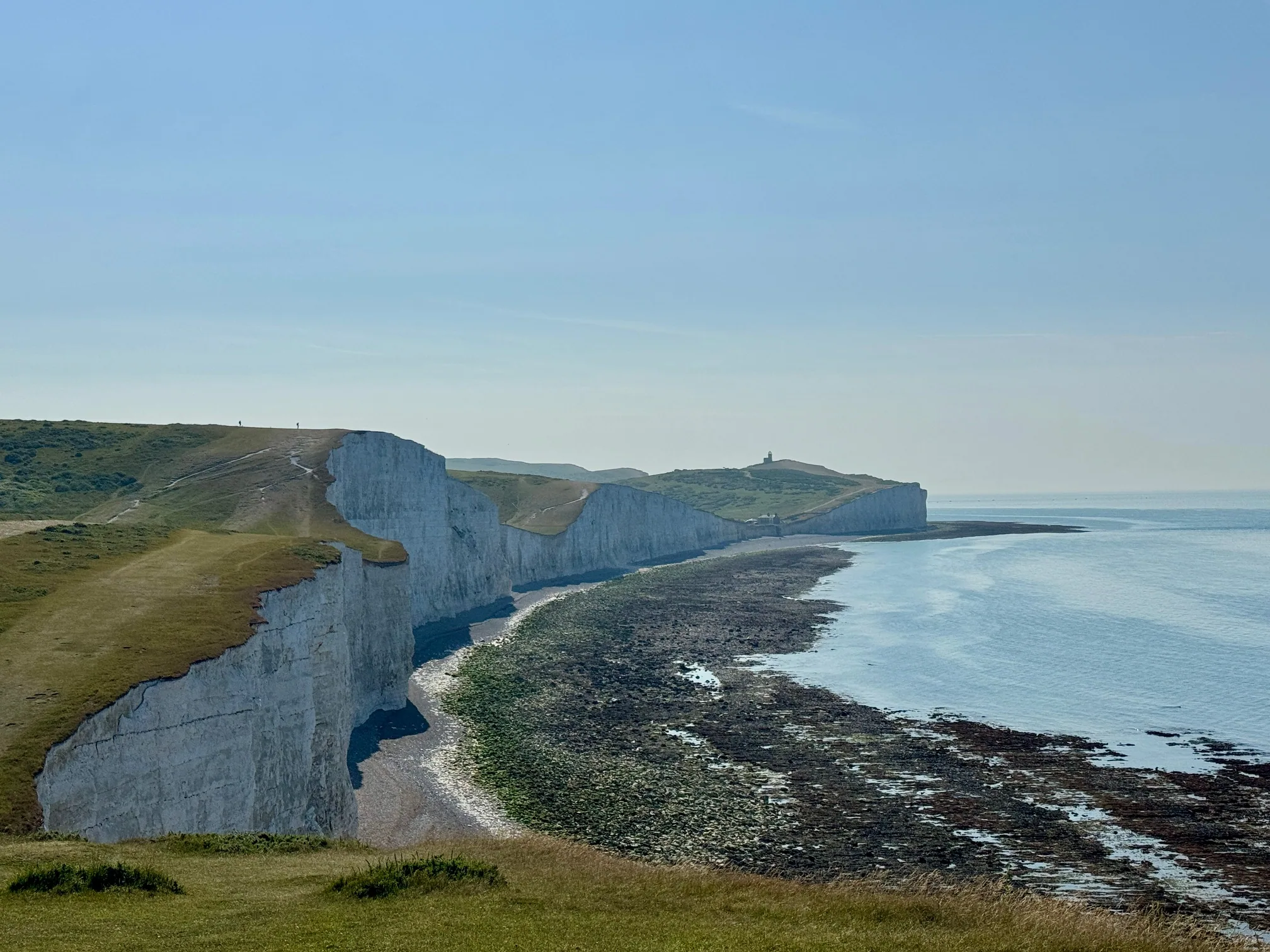
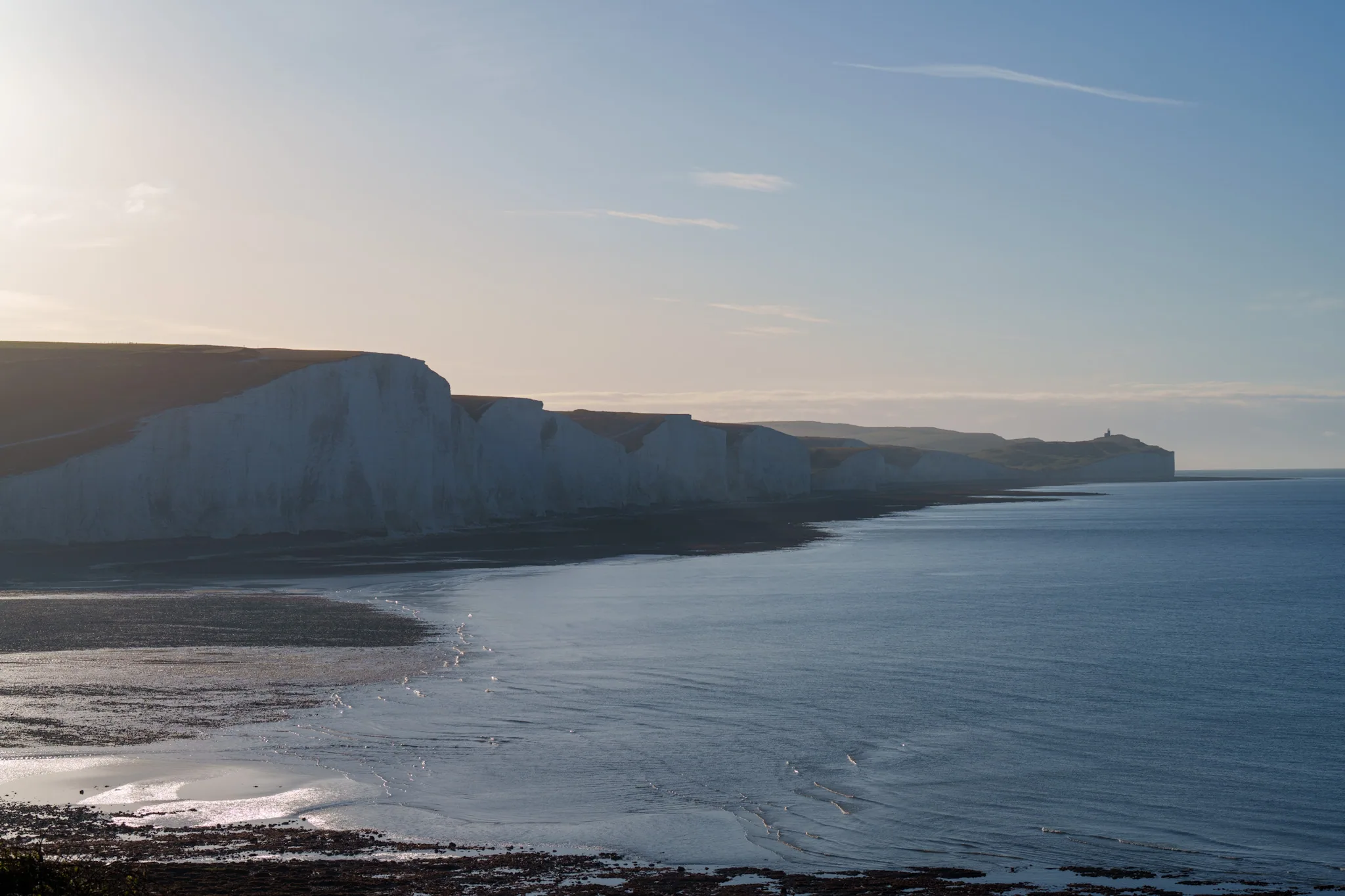
Where the Signal Actually Drops
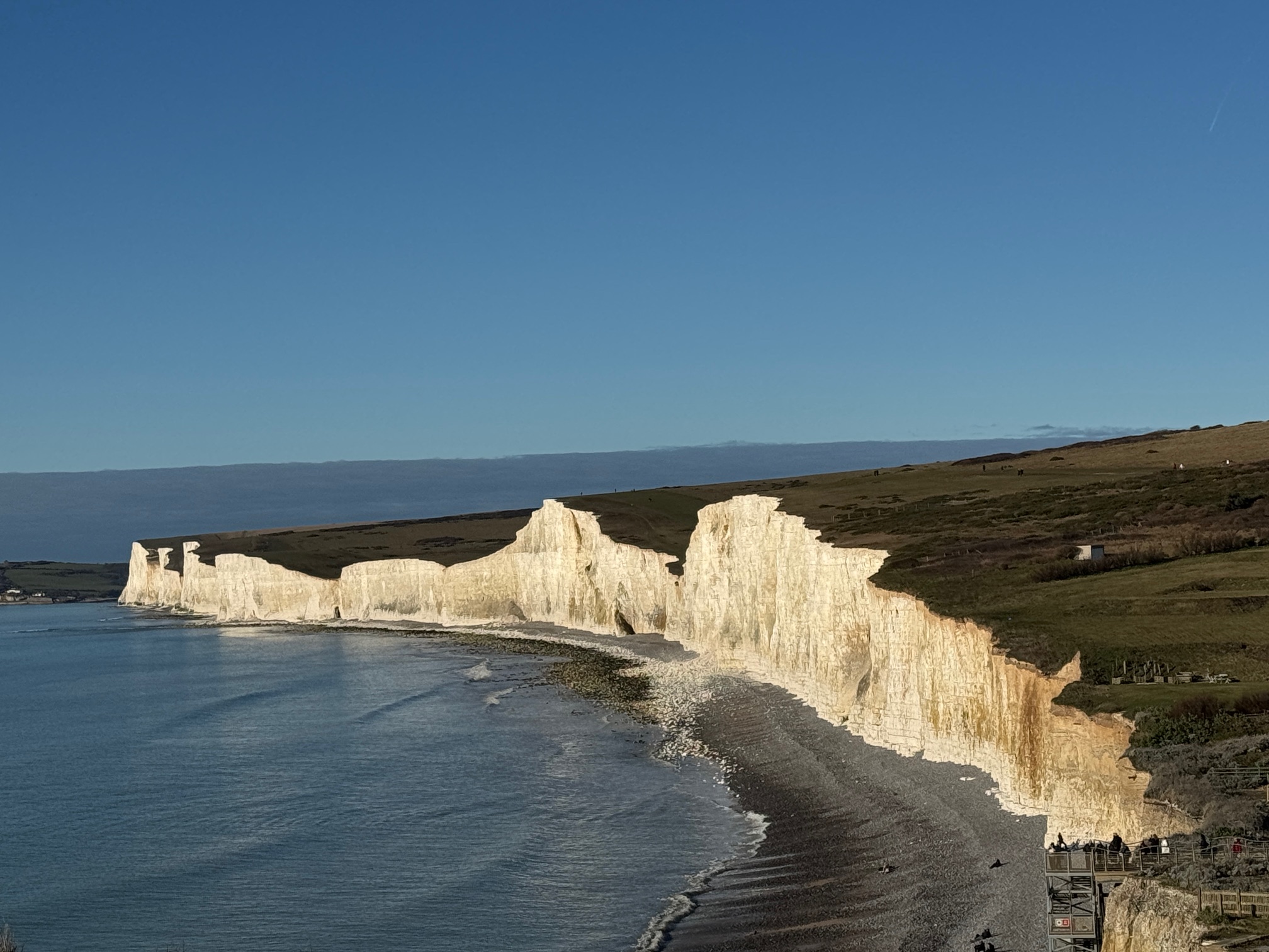
People arrive expecting either full bars all the way or a total blackspot. The reality sits in between, and it is worth knowing the pattern before you set off. Coverage here is shaped by the terrain: the ground rises and falls between each of the seven cliffs, and every dip puts a wall of chalk between you and the nearest mast.
In practice, this is where signal tends to hold and where it fails:
Western trailhead - generally reliable signal, road access
Eastern end - strongest signal zone on the walk
Tops of the seven summits on a clear day
The saddles the path drops into between each summit
The meander floor and the riverside path to the beach
Cuckmere Haven and Birling Gap beach at low tide
EE and O2 tend to give the best coverage across the ridge; Vodafone and Three are more variable. If you are walking as a group on mixed networks, the phone with a bar or two will change depending on where you are standing - which is exactly the kind of thing worth knowing before you need it.
One thing that never fails: GPS is not mobile signal. Your phone locates itself from satellites, which work everywhere the sky is open - so your blue dot keeps moving on a downloaded map even when you have zero bars. That single fact is the key to the whole problem below.
What to Do Before You Set Off
None of this takes more than a few minutes at home on Wi-Fi, and it turns a no-signal walk from a worry into a non-issue.
- Download an offline map of the route. Save the Seaford - Birling Gap - Eastbourne area while you are on Wi-Fi, so the map tiles live on your phone and your GPS can place you on them with no signal.
- Register for emergency text-999. Text the word register to 999 and follow the reply - about a minute. Texts sometimes get through where voice calls cannot, but only if you registered in advance. (The old emergencysms.net website has closed; registration is now by texting register to 999.)
- Install what3words. It works offline and gives any point on the ridge a three-word address accurate to three metres - the fastest way to tell the Coastguard exactly where you are.
- Start with a full battery, and bring a power bank. GPS and a bright screen in cold wind drain a phone quickly. A small power bank is cheap insurance.
- Tell someone your route and return time. "Walking Exceat to Birling Gap and back, starting 10am, back by 1pm." If you are overdue and out of contact, that message tells rescuers where to start.
- Screenshot your bus times. Save the timetable as an image so it is there when the app cannot load. Always check the live timetable for your date before you travel.
Your phone loses signal on the ridge. Your map shouldn't.
The Seven Sisters Ultimate Guide includes a live offline trail map built for exactly this problem. Save it once on Wi-Fi and your blue GPS dot keeps moving along the cliffs with no signal at all - the full Seaford to Eastbourne route and the riverside alternative, with every cliff, cafe, toilet, car park, bus stop and safety point marked.
- Live GPS blue dot that works completely offline
- Every exit, landmark and safety point along the ridge
- Plus the 24-page PDF: tide windows, parking strategy & day plans
Phone Signal FAQs
Is there phone signal on the Seven Sisters?
Partly, but not reliably. You will usually get signal in the Exceat and Birling Gap car parks and on the higher peaks on a clear day, but it drops out in the dips between the cliffs, in the Cuckmere valley, and below the cliff line. Do not plan on being able to call from any given point on the ridge.
Which network has the best coverage?
EE and O2 tend to be strongest along this coast; Vodafone and Three are more variable. No network gives continuous coverage across the whole walk, so within a group the phone with signal will change as you move.
Can I use Google Maps offline here?
Yes, if you save the area over Wi-Fi first - your GPS then works with no signal because it does not need mobile data. But Google Maps offline is built for roads, not the cliff path, so it will place you roughly on the coast rather than on the trail. A dedicated offline trail map is far more useful on the ridge.
Will I get lost without signal?
In clear weather the main path is hard to lose. The risks are the fork points - the Cuckmere valley return and the Exceat descents - and sudden sea fog, which can cut visibility to single figures in under two minutes. That is when an offline map with your live position matters most.
How do I call for help with no signal?
Move to the highest nearby point or toward a car park, then call 999 and ask for the Coastguard. If a voice call will not connect, a text may - but only if you registered your phone in advance by texting the word "register" to 999 before your walk. The what3words app works offline and pinpoints your location for rescuers. See the emergency guide for the full procedure.
What is the best offline map for the walk?
One that shows the real cliff path - not just roads - and keeps your live GPS position visible with no signal. The Ultimate Guide's offline trail map is built for this exact route and marks every exit, cafe, toilet, car park and safety point. Whatever you use, download it over Wi-Fi and start with a full battery.
Keep planning safely
Pair this with the emergency guide (who to call, what to say), the fog safety guide, the walking routes, and getting there for buses and parking. For the full picture, see the complete guide.