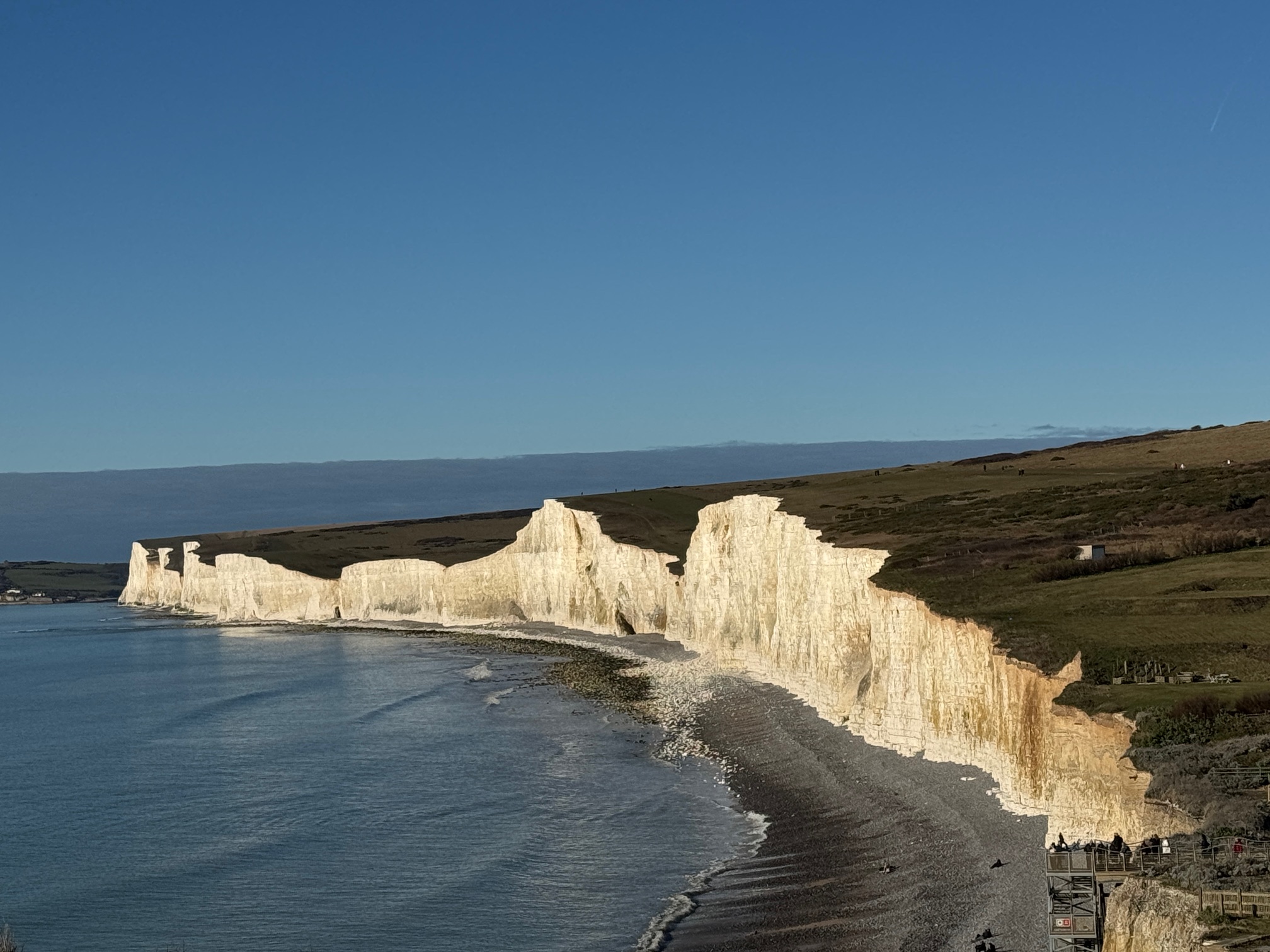
Seven Sisters
Weather Safety
Inland forecasts understate coastal conditions. Here is how to read what you are actually walking into.
Inland forecasts understate coastal conditions. Here is how to read what you are actually walking into.
Updated May 2026. Based on direct observation of conditions on this coast including winter storm walks, June fog events, and August heatwave walks on the ridge.
The weather your app shows when you're planning from the sofa is not the weather on the exposed chalk ridge six miles from Eastbourne. Coastal conditions here diverge from inland forecasts in specific, predictable ways. Here is how to read them correctly.
Weather emergency on the cliff: 999 → Coastguard. If caught in a storm, move away from the cliff edge and descend via the nearest valley path.
Quick Answer — Weather Safety at Seven Sisters
Inland weather forecasts consistently understate conditions on the ridge. Wind speeds at the cliff top are typically 20–30% higher than the nearest town forecast. The go/no-go threshold is sustained wind above 35 mph (Beaufort 7) — beyond which staying upright on the exposed ridge is difficult. January and February carry the highest storm risk; September and October are the most reliably pleasant months. Always check a coastal-specific forecast, not a town forecast, before walking.
CoastMetric pulls together real-time wind speed, visibility, temperature, and UV data for this specific stretch of the Sussex coast and produces a single visit score. It is the quickest way to check whether today is genuinely suitable for the ridge walk.
Data from coastmetric.com — coastal conditions specific to the Seven Sisters walk
Standard weather apps — BBC Weather, Google Weather, Apple Weather — use model data calibrated to nearby land stations. The closest inland stations to Seven Sisters are in Eastbourne and Lewes. On a day when those stations record a 12 mph southwest breeze, the exposed chalk ridge at Went Hill Brow is often seeing 20–28 mph with gusts in the 35 mph range. The difference comes from coastal funnelling, the lack of any windbreak across the Channel fetch, and the elevation change as air accelerates over the cliff edge.
The Met Office does have a coastal station at Shoreham, and its spot forecasts for grid points on the cliff are more accurate than app-level summaries. Even so, the forecasts routinely understate wind on the headlands by 8–15 mph in southwest flow — which is the dominant wind direction here. The practical approach is to take whatever wind speed your app shows, add 10 mph to it as a working estimate for the exposed ridge, and make your decision on that figure.
Temperature is similarly understated. The wind chill effect at 25 mph wind turns a 12°C day into a feels-like 5°C experience on the open ridge. People arrive at Birling Gap in a fleece adequate for the car park and are cold within 20 minutes of starting the climb.
These thresholds apply to the exposed chalk ridge — the full cliff walk from Cuckmere Haven to Birling Gap. The valley path (inland of the cliff edge through the Cuckmere valley) is significantly more sheltered in all conditions.
| Condition | Threshold | Verdict |
|---|---|---|
| Wind (sustained) | Below 25 mph | Go — standard caution |
| Wind (sustained) | 25–40 mph | Experienced walkers only — shorten route, stay back further from edge, avoid highest headlands |
| Wind (sustained) | Above 40 mph | Do not walk the ridge |
| Visibility | 50 m or more | Go — carry offline map |
| Visibility | 20–50 m | Stay on path, avoid cliff edge, know your exit point — see fog guide |
| Visibility | Below 20 m | Move inland immediately. Do not walk cliff edge. |
| Rain | Light rain, good visibility | Go — waterproofs required, chalk gets slippery |
| Rain | Heavy or driving rain | Reduce pace significantly, avoid cliff edge, consider turning back |
| Temperature | Above 5°C (with wind chill) | Go — dress appropriately |
| Temperature | Below 5°C with wind and rain | Hypothermia risk underestimated by most visitors — full waterproof shell, insulating mid-layer, hat and gloves required |
Wind speeds above refer to the forecast at coastal stations — add 10 mph to inland forecasts to estimate actual ridge conditions.
Each month has a dominant hazard. Knowing which one is in season tells you what to check before you leave.
Atlantic low-pressure systems dominate. Gusts regularly exceed 50 mph on the exposed ridge; 70+ mph is not unusual in named storms. Daylight is 8 hours maximum. Paths are often muddy, chalk cliff-top grass is slippery when frozen. The walk is possible on settled days between systems but requires checking forecasts the morning of, not the night before. Conditions change faster than the forecast models capture in winter.
Storm frequency drops significantly by late March. The transition period brings highly variable conditions — cold easterly winds off the North Sea are common and feel far colder than the air temperature suggests. March and April have the lowest sea fog incidence of any month, making them some of the clearest walking conditions of the year on days with settled pressure. Easter bank holidays typically bring the first big summer-style crowds, often in genuinely cold conditions.
The highest sea fog incidence of the year. Warm air moving over a still-cold Channel produces sea fret that can reduce visibility to zero in under two minutes, even on days where the morning started with brilliant sunshine. The Met Office forecast often shows "sunny" because it is — 10km inland. On the cliff, the difference between a clear walk and a white-out can happen before you have time to check your phone. May and June in particular: if you see a bright white haze building on the horizon, move inland before it arrives. See the fog safety guide for the full sequence and decision framework.
The most reliably clear weather for the walk — fog incidence drops, storm risk is minimal, winds are lighter. The primary hazard shifts to heat and UV exposure on the shadeless 6km ridge. Chalk reflects ultraviolet from below as well as the sun burning from above. People consistently underestimate how much sun exposure they are getting because the sea breeze keeps them feeling cool. See the heat and sun guide. Peak crowding also makes parking difficult — check conditions before 9am or after 4pm.
Consistently the best weather window for the walk. Lower crowd density, excellent visibility, warm enough not to require winter layers but cool enough that the ridge climbs are comfortable. Fog incidence drops significantly from summer peaks. The main shift is the return of Atlantic systems in October — check for approaching gales when booking autumn half-term visits. Daylight shortens noticeably through October; earlier starts become important on longer routes.
Atlantic gales return, daylight drops to 7.5 hours by December, and the chalk paths become treacherous after rain — polished chalk is close to ice in wet conditions. There are genuinely good days in November and December — clear, still, with the low winter light that photographers love — but these need to be identified from forecasts, not assumed. Plan morning walks only. Never start a full Cuckmere to Birling Gap ridge walk after midday in November or December.
The hierarchy that gives the best picture for the Seven Sisters walk:
CoastMetric (coastmetric.com): Built specifically for coastal walking conditions on this stretch of coast. Aggregates wind, visibility, UV, and swell into a single visit score calibrated for the Seven Sisters ridge. Check this first.
Met Office spot forecast for Beachy Head grid: The Met Office Mountain and Coastal forecast for the South Downs gives wind and visibility data for the coastal station rather than inland interpolations. More accurate than consumer-facing apps for exposed coastal locations.
Windy.com (set to 10m altitude layer): Useful for seeing the actual wind field across the Channel and understanding whether the wind will strengthen or ease during your walk. The time-lapse view shows fronts and pressure systems moving in real time.
Not useful for accurate conditions: BBC Weather town forecasts, Google Weather, Apple Weather — all use interpolated model data that smooths out the coastal effect. Fine for planning in broad terms; not reliable for go/no-go decisions on the exposed ridge.
A note that surprises most first-time visitors: the chalk cliff-top paths become significantly slippery in rain, in a way that grass-covered paths or gravel tracks do not. The chalk surface gets polished by millions of footsteps each year. In wet conditions, particularly on the descents into the dry valleys between each sister, the path can approach ice-like traction. The descent back into the valley at Birling Gap after walking from Cuckmere involves a steep chalk slope that catches people out even in light rain.
Good walking boots with mud-gripping soles make a significant difference. Smooth-soled trainers and any kind of fashion boot are genuinely dangerous on wet chalk descents. This is not a question of experience — it is a surface traction issue.
CoastMetric (coastmetric.com) provides the most useful single number — a visit score calibrated specifically for the Seven Sisters walk based on wind, visibility, UV and temperature. For the underlying data, the Met Office coastal grid forecast is more accurate than BBC Weather or Google Weather, which use inland-calibrated models that routinely understate wind speeds on the exposed ridge by 8–15 mph.
Above 40 mph sustained wind (Beaufort Force 7) on the exposed chalk ridge, staying upright near the cliff edge becomes difficult and the risk of being physically pushed is real. Between 25–40 mph, experienced walkers can manage with care — staying well back from the edge and avoiding the highest exposed headlands. Below 25 mph is standard walking conditions. Add 10 mph to any inland forecast figure to estimate actual ridge conditions.
January and February carry the highest storm risk — Atlantic low-pressure systems can produce gusts above 60 mph on the exposed ridge, and daylight is limited to 8 hours. May, June and July carry the highest sea fog risk. November and December bring the return of Atlantic gales combined with very short daylight. September and October are consistently the best weather months.
Standard weather apps use model data calibrated to inland stations — the closest are in Eastbourne and Lewes. The exposed chalk ridge sees coastal funnelling, the full Channel fetch with no windbreak, and wind acceleration over the cliff edge. The practical correction: add 10 mph to any inland forecast as a working estimate of actual ridge conditions.
Light rain with good visibility is manageable — wear waterproofs and be aware that chalk paths become significantly slippery when wet. Smooth-soled footwear is genuinely dangerous on wet chalk descents. Heavy or driving rain reduces visibility and makes the cliff-top path treacherous on the descents. In heavy rain, reduce pace, avoid the cliff edge entirely, and consider turning back if conditions are worsening.
Move away from the cliff edge immediately. Descend to the nearest exit point via the inland valley path. Seek shelter at Birling Gap (National Trust café) or Exceat (Country Park visitor centre). In lightning, avoid isolated trees — crouch low in a dry valley hollow rather than standing on the exposed ridge top. Do not shelter on the cliff edge in any storm conditions.
For the specific sea fog decision framework — visibility thresholds, what to do at each level, and the arrival sequence to watch for — see the fog safety guide. For heat and UV risk in summer conditions, see the heat and sun guide. For emergency contacts and storm response instructions, see the emergency guide. For the full safety overview, see the safety hub.
Wind on the exposed ridge is a different proposition to the sheltered valley path. Compare the four routes before you commit to a day.
£4.99 · 24-page PDF · Instant download
The complete 24-page companion built from first-hand walks — every cliff, all four graded routes, tide windows and a parking strategy. Designed to work offline, right on the cliff top.
Just want the basics? Download the free 2-page walk guide
Stay up to date with seasonal guides, crowd forecasts, and local tips — direct to your inbox.
No spam. Only coastal inspiration and timing tips — unsubscribe any time.